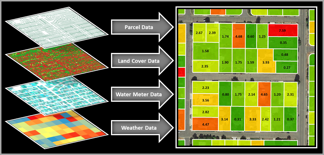
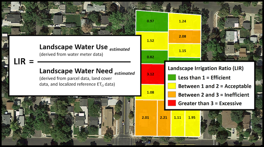
The WaterMAPS™ program integrates parcel data, land cover data, water meter data, and weather data to calculate and geographically display a measurement called a Landscape Irrigation Ratio (LIR). LIR values, which represent an efficiency standard, compare the landscape water use to the landscape water need within a parcel.
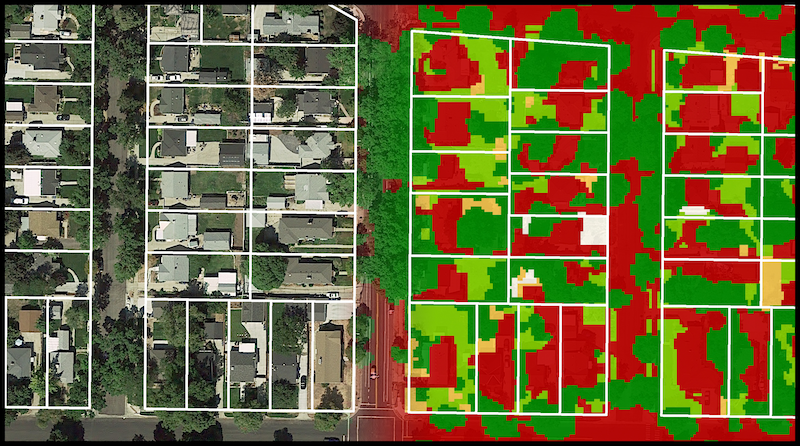
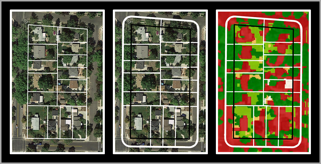
The landscape, or outdoor, water use is calculated by subtracting the estimated indoor water use from water meter or billing data. In geographic locations where winter irrigation is unnecessary, the indoor water use is estimated by calculating the average water use during the winter months of December through February. The landscape water need is calculated from high-resolution land cover data and weather data. The landcover data are used to calculate the areas of different irrigated land cover types within a parcel, and the weather data are used to assess the amount of water that each of those land cover types require based on reference evapotranspiration rates during the irrigation season.
Since LIR values are a ratio of landscape water use to landscape water need, values at or under 1 suggest efficient water use. Increasing ratio values suggest there is an opportunity for water conservation. LIR values can therefore be categorized and labeled (e.g., efficient, acceptable, inefficient, or excessive) to provide an indication of the appropriateness of landscape water use to meet landscape water need. By standardizing the calculations per unit of landscaped area, the LIR values eliminate differences in water use due to parcel size and provide an objective measure of irrigation efficiency.