Yellow River - Paria River
1921
2004
Description:
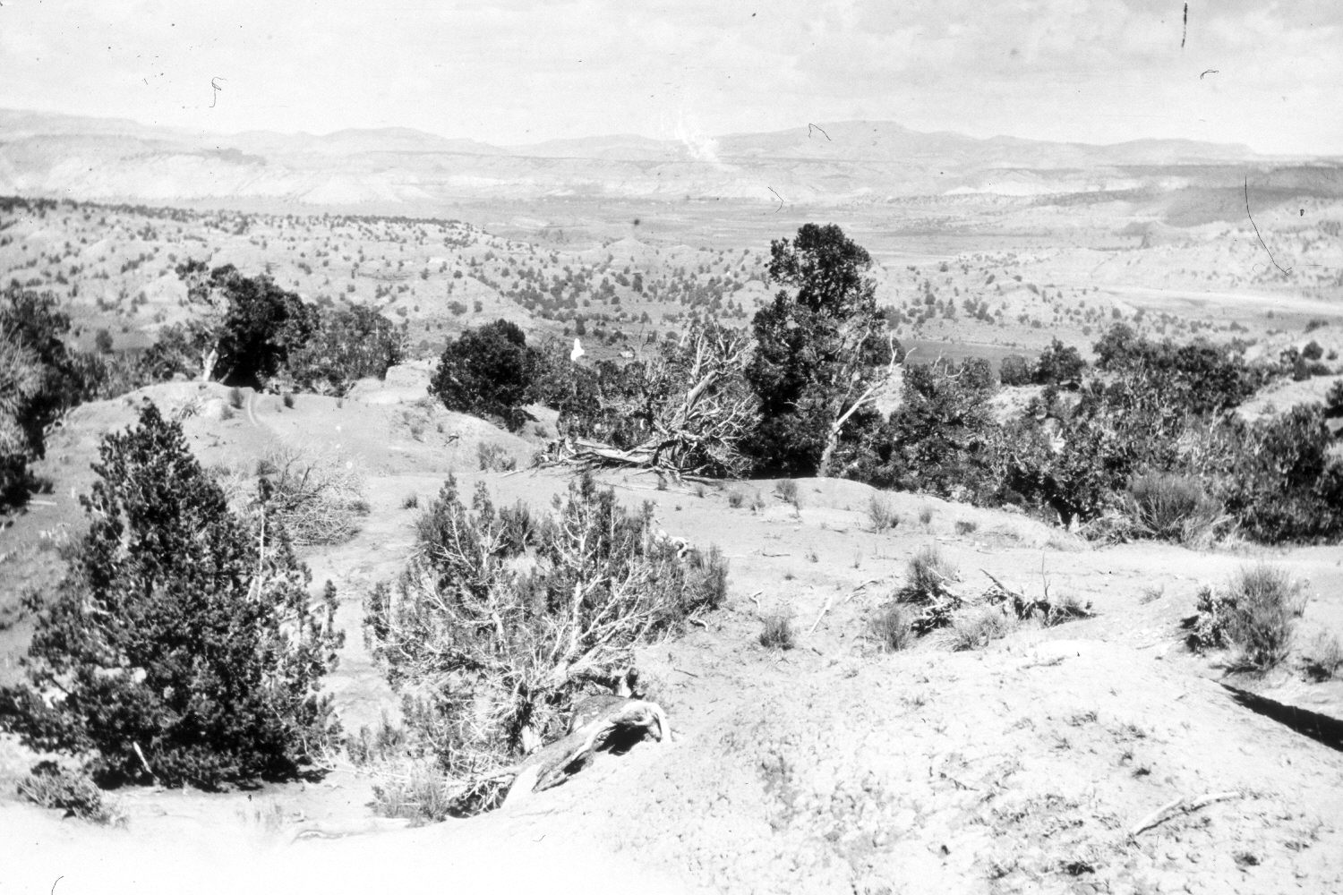
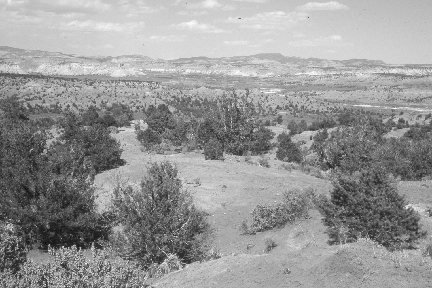
Plate 413X. Yellow Creek – Paria River 1921 – 2004 Plates 413x and 414x form a panorama. Plate 413x is viewed northeast across the lower portion of Yellow Creek near Cannonville, UT. The Paria River is in the distance, while Canaan Peak (9,293 ft.) is on the right-center skyline. The photopoint is on the ridge between Yellow Creek and Sheep Creek. Pinyon and juniper have increased, as has woody riparian vegetation along the Paria River.
Photo Information:
Original photograph taken by R.C. Moore (No. 150) in 1921; retake by Charles E. Kay on May 11, 2004 - - Photo No. 5296-11. Original photograph held by the U.S. Geological Survey Photographic Library, Denver, CO.
Vegetative Community:
Pinyon, Juniper, Riparian
Location:
South West: Section 1, Range 3 West, Township 38 South; UTM 405500 E, 4154100 N; elevation 6,100 ft.