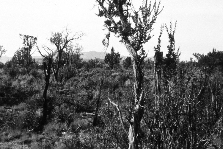
Wide Canyon
1962
2004
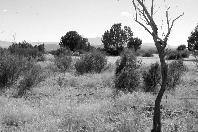
Description:
Plate 740X. Wide Canyon 1962 – 2004 Viewed southwest along the third utilization transect established by the Forest Service to monitor range conditions near the head of Wide Canyon. Cliff rose plants were heavily browsed in 1962 but that is not the case today as deer numbers have declined precipitously. Much of the site burned 7 to 8 years ago and cheatgrass is now firmly entrenched. Despite the fire, pinyon and juniper have increased. The fence seen in the 1962 image was burned by the fire and the wires are now on the ground.
Photo Information:
U.S. Forest Service photograph (unnumbered) taken by Ivan Thornton on October 30, 1962; retake by Darrell McMahon on August 7, 2004 - - Photo No. DM-45-4. Original photographs, negatives, and narrative reports held in the range files on the St. George Ranger District, Dixie National Forest, St. George, UT.
Vegetative Community:
Pinyon, Juniper, Sagebrush
Location:
South West: Section 24, Range 16 West, Township 41 South; UTM 270566 E, 4130714 N; elevation 5,687 ft.