White Rocks
1952
2007
Description:
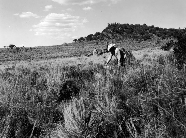
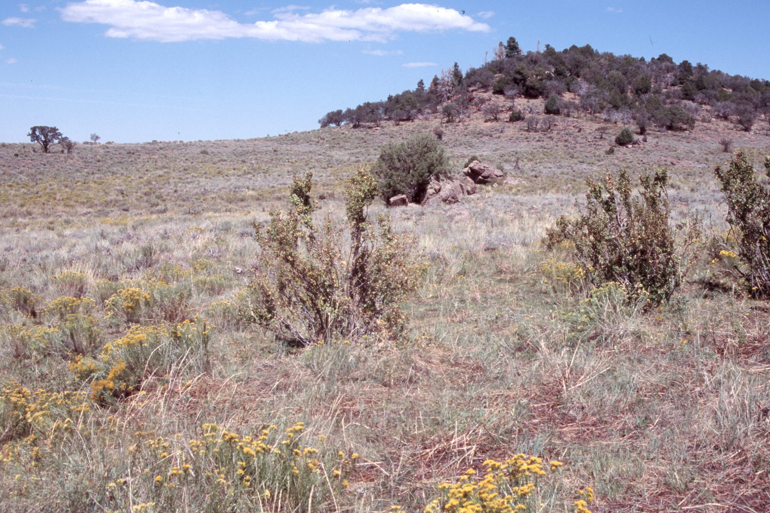
Plate 1508X. White Rocks 1952 – 2007 During 1952, the Forest Service established three Parker-Three Step Transects at the head of White Rocks Draw in the Pine Valley Mountains. Plate 1508x is viewed northeast at the start of the third transect. “Tree-in-the-Rock” is the second boulder in the distance - - see Plate 1502x. Sagebrush has declined, while rubber and green rabbitbrush have increased. The tall, heavily browsed shrubs in the foreground are currants, which normally are not eaten by cattle. Pinyon, juniper, and Douglas fir have increased on the far hillside. All the curlleaf mountain mahogany and Utah serviceberry in the distance have been highlined and heavily browsed. The area was actively being grazed by cattle in 2007 and utilization was heavy.
Photo Information:
Forest Service photograph (unnumbered) taken by B. Cook on August 11, 1952; retake by Charles E. Kay on August 24, 2007 - - Photo No. 5836-9. Original photographs, negatives, and narrative reports held in the range files on the St. George Ranger District, Dixie National Forest, St. George, UT.
Vegetative Community:
Sagebrush, Mountain Brush
Location:
South West: Section 14, Range 14 West, Township 38 South; UTM 287836 E, 4150801 N; elevation 8,186 ft.