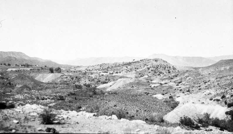
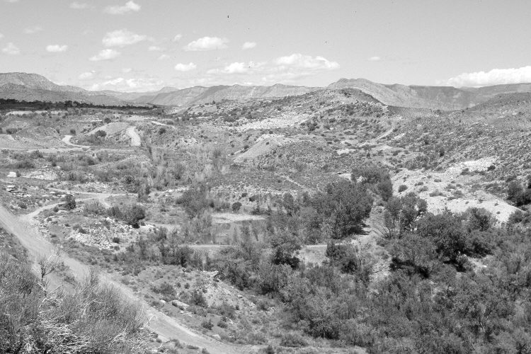
White Reef
1922
2004
Description:
Plate 660X. White Reef 1922 – 2004 Viewed northeast from White Reef to the Silver Reef mining district. Note the mine spoil piles in the original and the retake. Plates 659x, 660, 661x, and 662x form a panorama. New roads have been added and a dike has been built across Leeds Creek. Woody riparian vegetation has increased, as have pinyon and juniper in the distance. Shrubs include Mormon tea, blackbrush, cliff rose, skunk brush, creosote bush (Larrea tridentata), and indigo bush (Dalea fremontii). Cheatgrass and galleta grass are also common. Buckeye Reef is on the other side of Leeds Creek.
Photo Information:
Original photograph taken by Hess (No. 1026) on May 29, 1922; retake by Darrell McMahon on May 12, 2004 - - Photo No. DM-8-19. Original photograph held by the U.S. Geological Survey Photographic Library, Denver, CO.
Vegetative Community:
Riparian, Pinyon, Juniper, Dry Meadow
Location:
South West: Section 12, Range 14 West, Township 41 South; UTM 288927 E, 4123922 N; elevation 3,644 ft.