White Pine Peak Pavant Mountains
1955
2000
Description:
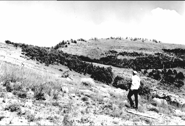
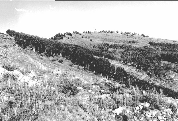
Plate 273. WHITE PINE PEAK PAVANT MOUNTAINS 1955-2000 Viewed northeast to White Pine Peak in the Pavant Mountains. This area was gully-plugged, contour-trenched, and reseeded by the Forest Service to control erosion. The men in the original are surveying for a contour-trench. Aspen has increased in height, but most stands have not regenerated due to excessive browsing. Limber pine has increased on White Pine Peak and radio towers have also been added.
Photo Information:
U.S. Forest Service photo (unnumbered) taken in September 1955; retake by Charles E. Kay on September 2, 2000 - - Photo No. 4679-16A; Original photo (2520-2-A240) held by Fillmore Ranger District, Fishlake National Forest, Fillmore, UT.
Vegetative Community:
Aspen, Conifer
Location:
South Central: Section 25, Range 4 W, Township 22 S; UTM 392250 E, 4302400 N; elevation 9,960 ft.