White Pine Creek Pavant Mountains
1962
2000
Description:
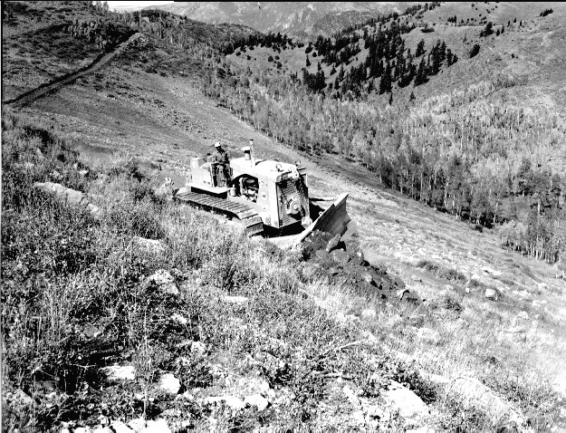
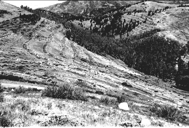
Plate 282. WHITE PINE CREEK PAVANT MOUNTAINS 1962-2000 Viewed north down White Pine Creek in the Pavant Mountains. This area was contour-trenched, gully-plugged, and reseeded by the Forest Service in 1962 to control erosion. Conifers have increased. Aspen has increased in height but has not regenerated due to repeated browsing. The shrubs are snowberry, currant, big sage, and curlleaf mountain mahogany. The photopoint is just above USFS Road 096.
Photo Information:
U.S. Forest Service photo (unnumbered) by L. Glen Quigley on November 7, 1962; retake by Charles E. Kay on September 3, 2000 - - Photo No. 4712-22; Original photo (2500B-79) held by Fillmore Ranger District, Fishlake National Forest, Fillmore, UT.
Vegetative Community:
Conifer, Aspen, Mountain Brush, Sagebrush
Location:
South Central: Section 33, Range 3 W, Township 22 S; UTM 395400 E, 4301400 N; elevation 9,380 ft.