White Pine Creek Pavant Mountains
1962
2000
Description:
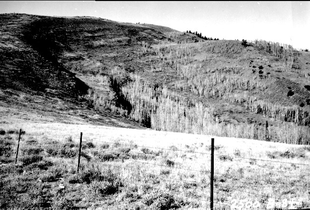
Plate 298. WHITE PINE CREEK PAVANT MOUNTAINS 1962-2000 Plates 297 and 298 form a panorama from west to northwest across the head of White Pine Creek in the Pavant Mountains. Parts of this area were contour-trenched, gully-plugged, and reseeded by the Forest Service to control erosion. Aspen has increased in height, but has not regenerated due to excessive browsing by wild and domestic ungulates. Big sage, currant, and snowberry are the common shrubs. Curlleaf mountain mahogany is also present on the far hillside. Plate 298 is viewed west to White Pine Peak.
Photo Information:
U.S. Forest Service photo (unnumbered) taken on November 7, 1962; retake by Charles E. Kay on September 2, 2000 - - Photo No. 4712-8: Original photo (2500B-84) held by Fillmore Ranger District, Fishlake National Forest, Fillmore, UT.
Vegetative Community:
Aspen, Sagebrush, Mountain Brush
Location:
South Central: Section 32, Range 3 W, Township 22 S; UTM 394400 E, 4301350 N; elevation 9,520 ft.