West Fork Of Merchant Creek
1924
2001
Description:
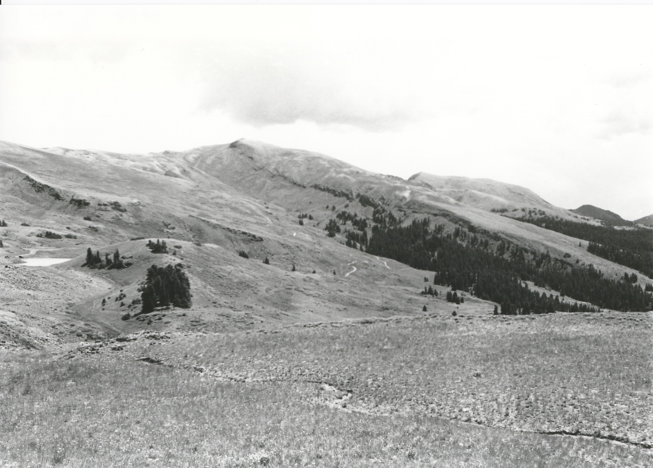
Plate 313. WEST FORK OF MERCHANT CREEK TUSHER MOUNTAINS 1924-2001 Viewed southeast across the head of the West Fork of Merchant Creek to Delano Peak (left - - 12,169 ft) and Mount Holly (right - - 11,985 ft). Conifers, primarily spruce, have increased in height, numbers, and to a limited extent in distribution. The area is no longer grazed by domestic sheep but does receive use by cattle. Ground cover appears to have increased. Mud Lake is visible on the left edge of the photos and a new access road is visible in the retake.
Photo Information:
U.S. Forest Service photo taken in 1924; retake by Charles E. Kay on August 7, 2001 - - Photo No. 4864-34; Original photo (2310-Fishlake-20) held by the Forest Service Regional Office Photographic Collection housed at Weber State University, Ogden, UT.
Vegetative Community:
Conifer, Dry Meadow
Location:
South Central: Section 15, Range 5 W, Township 28 S; UTM 377000 E, 4248700 N; elevation 11,160 ft.