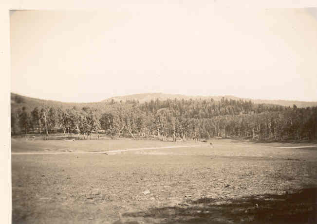
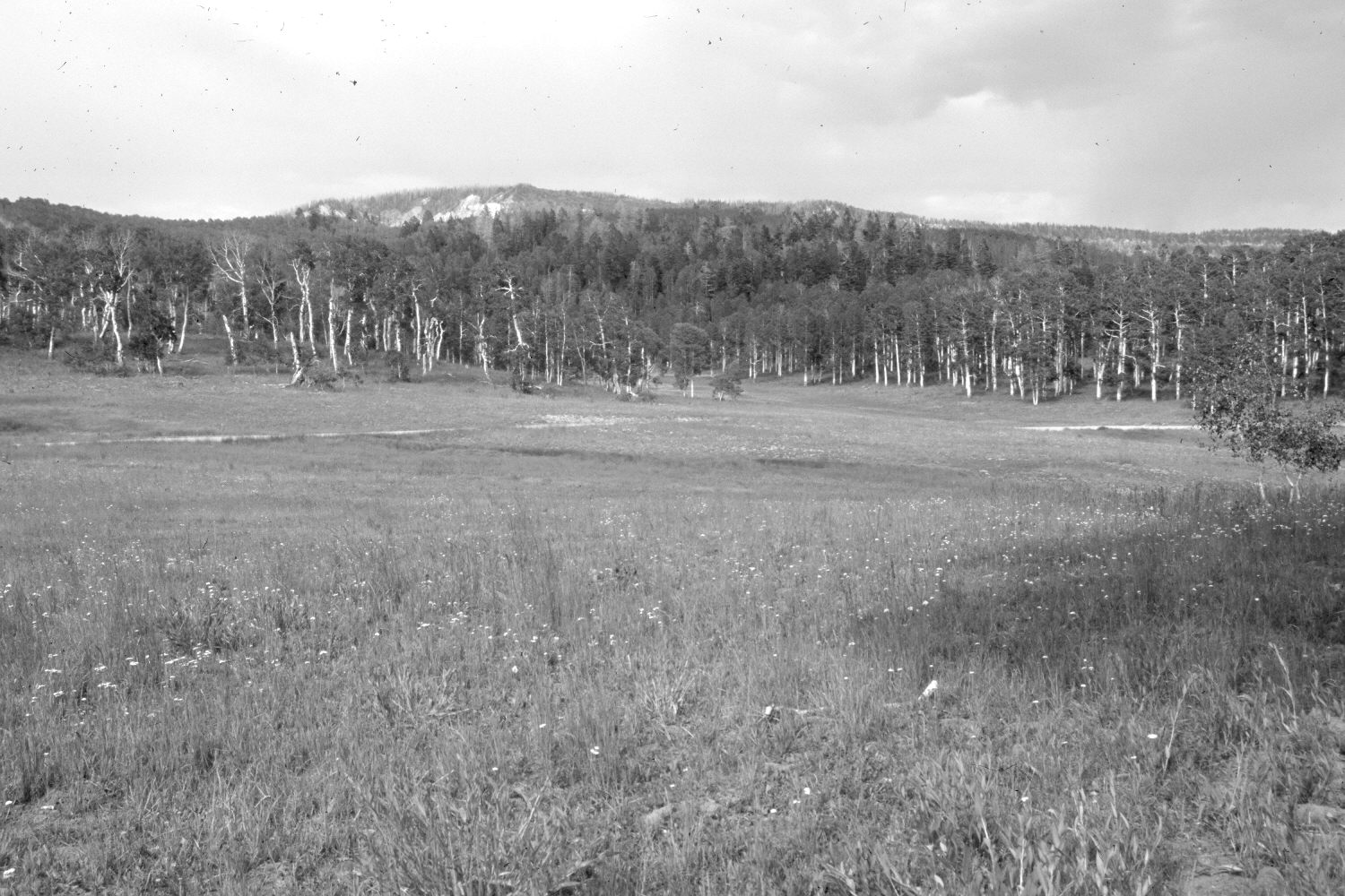
Webster Flat
1936
2006
Description:
Plate 1357X. Webster Flat 1936 – 2006 Viewed northeast across Webster Flat. The meadow is more vegetated today than in the past and soil erosion has been eliminated. The area was actively being grazed by domestic sheep in 2006. Except for a handful of new saplings, aspen has not successfully regenerated in many years due to excessive ungulate browsing (Ohms 2003). Conifers have increased. The photopoint is located at the turning point on the old snow survey course and is viewed back to the snow course’s starting point (Plate 1338x).
Photo Information:
Original photograph (NRCS-216) taken on September 8, 1936; retake by Charles E. Kay on July 17, 2006 - - Photo No. 5700-27. Original photograph held by the Snow Survey Supervisor, Natural Resources Conservation Service, Salt Lake City, UT.
Vegetative Community:
Aspen, Conifer
Location:
South West: Section 29, Range 9 West, Township 37 South; UTM 331730 E, 4159800 N; elevation 9,120 ft.