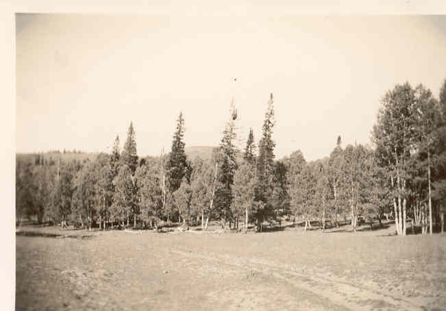
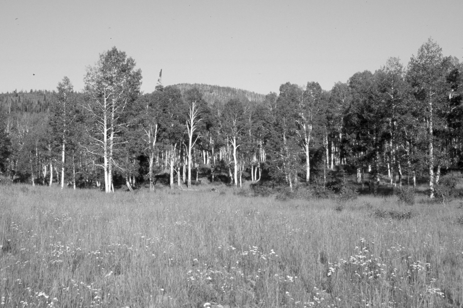
Webster Flat
1936
2006
Description:
Plate 1337X. Webster Flat 1936 – 2006 Viewed west-southwest to Black Mountain (10,400 ft) from Webster Flat. The meadow is more vegetated today than in the past and soil erosion has been eliminated. The area was actively being grazed by domestic sheep in 2006. All but one of the old spruce seen in the 1936 image have recently been killed by insects and disease. Nonetheless conifers have increased. Most aspen has failed to regenerated due to excessive browsing by domestic sheep (Ohms 2003). The photopoint is located at station 15 on the old snow survey course.
Photo Information:
Original photograph (NRCS-215) taken on September 8, 1936; retake by Charles E. Kay on July 17, 2006 - - Photo No. 5693-32. Original photograph held by the Snow Survey Supervisor, Natural Resources Conservation Service, Salt Lake City, UT.
Vegetative Community:
Conifer, Aspen, Dry Meadow
Location:
South West: Section 29, Range 9 West, Township 37 South; UTM 331800 E, 4159800 N; elevation 9,120 ft.