Virgin River
1872
2006
Description:
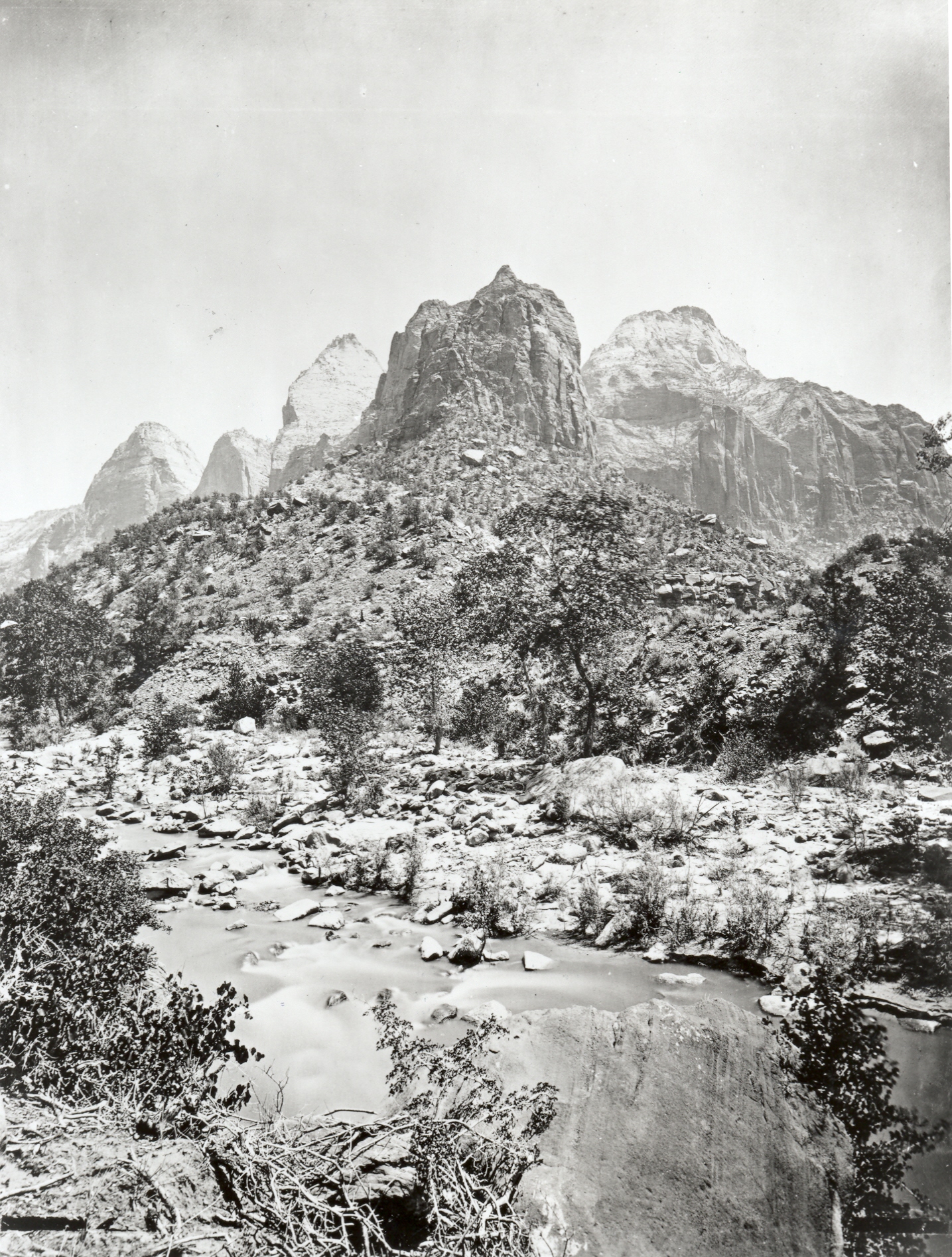
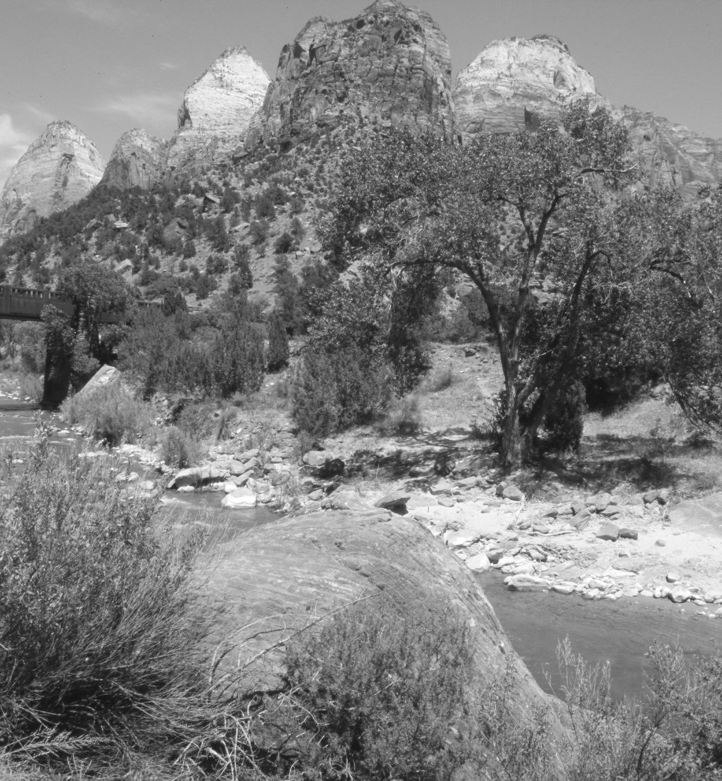
Plate 1199X. Virgin River 1872 – 2006 Viewed northeast across the Virgin River in Zion National Park. In the distance, Mount Spry (5,280 ft) is in the center, while East Temple (7,709 ft) is on the right. To the left of Mount Spry are the Twin Brother (6,663 ft) and the Mountain of the Sun (6,722 ft). Pinyon and juniper have increased on the distant slope, as has turbinella oak. Pinyon and juniper have also invaded the floodplain. The photopoint is just across from the mouth of Pine Creek. At the left edge of the retake is the highway bridge across the Virgin River - - see plate 1198X. Note the young cottonwoods along the Virgin River in 1872 and the absence of young cottonwoods today due to eXcessive browsing by an unnatural concentration of mule deer (Ripple and Beschta 2006). The river has rearranged the boulders on its floodplain during high water events.
Photo Information:
Original photograph taken by John Hillers (No. 76) in 1872; retake by Charles E. Kay on June 6, 2006 - - Photo No. 5635-31A. Original photograph held by the U.S. Geological Survey Photographic Library, Denver, CO.
Vegetative Community:
Pinyon, Juniper, Riparian
Location:
South West: Section 15, Range 10 West, Township 41 South; UTM 324800 E, 4120600 N; elevation 4,020 ft.