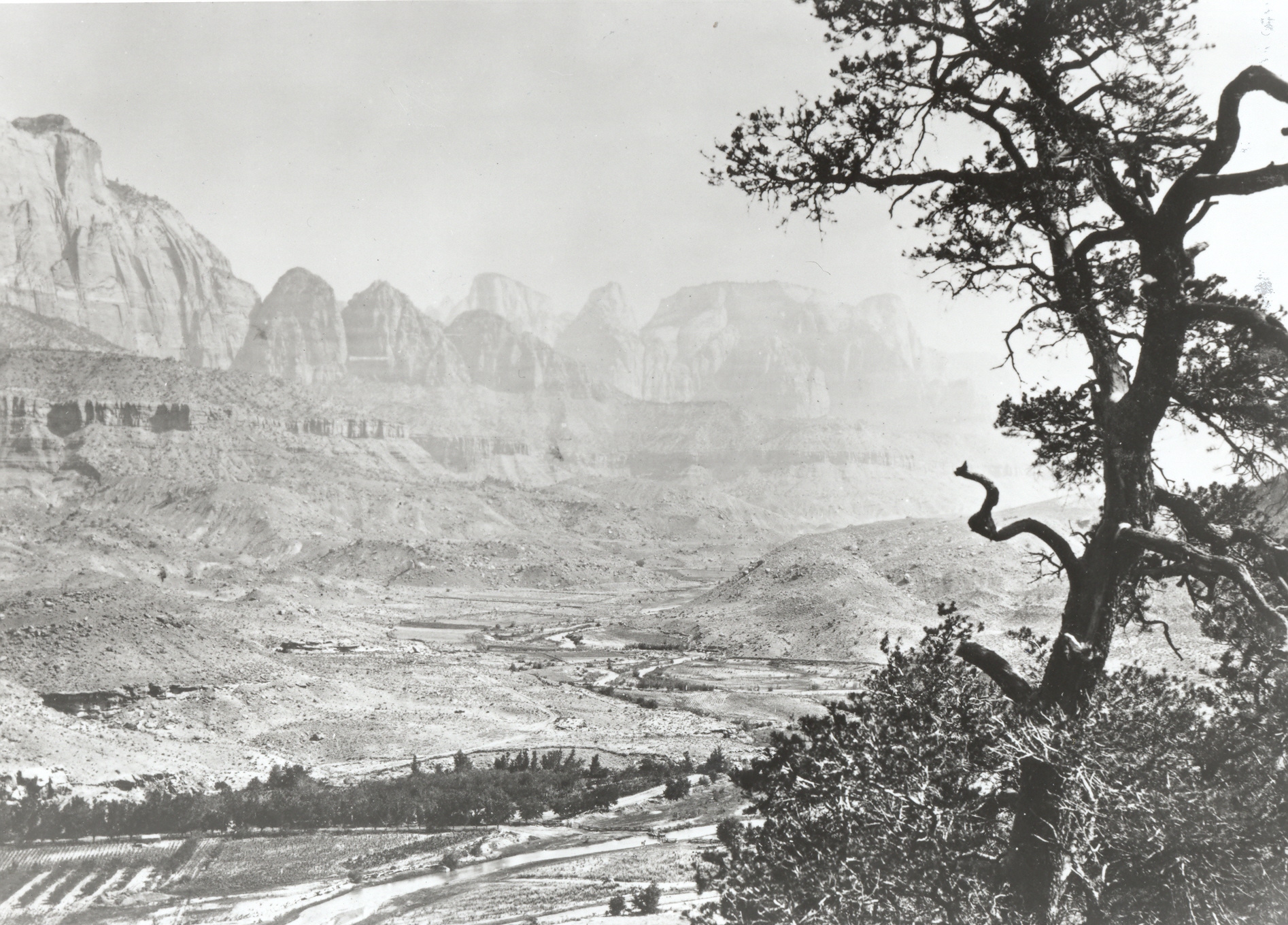
Virgin River
1872
2006
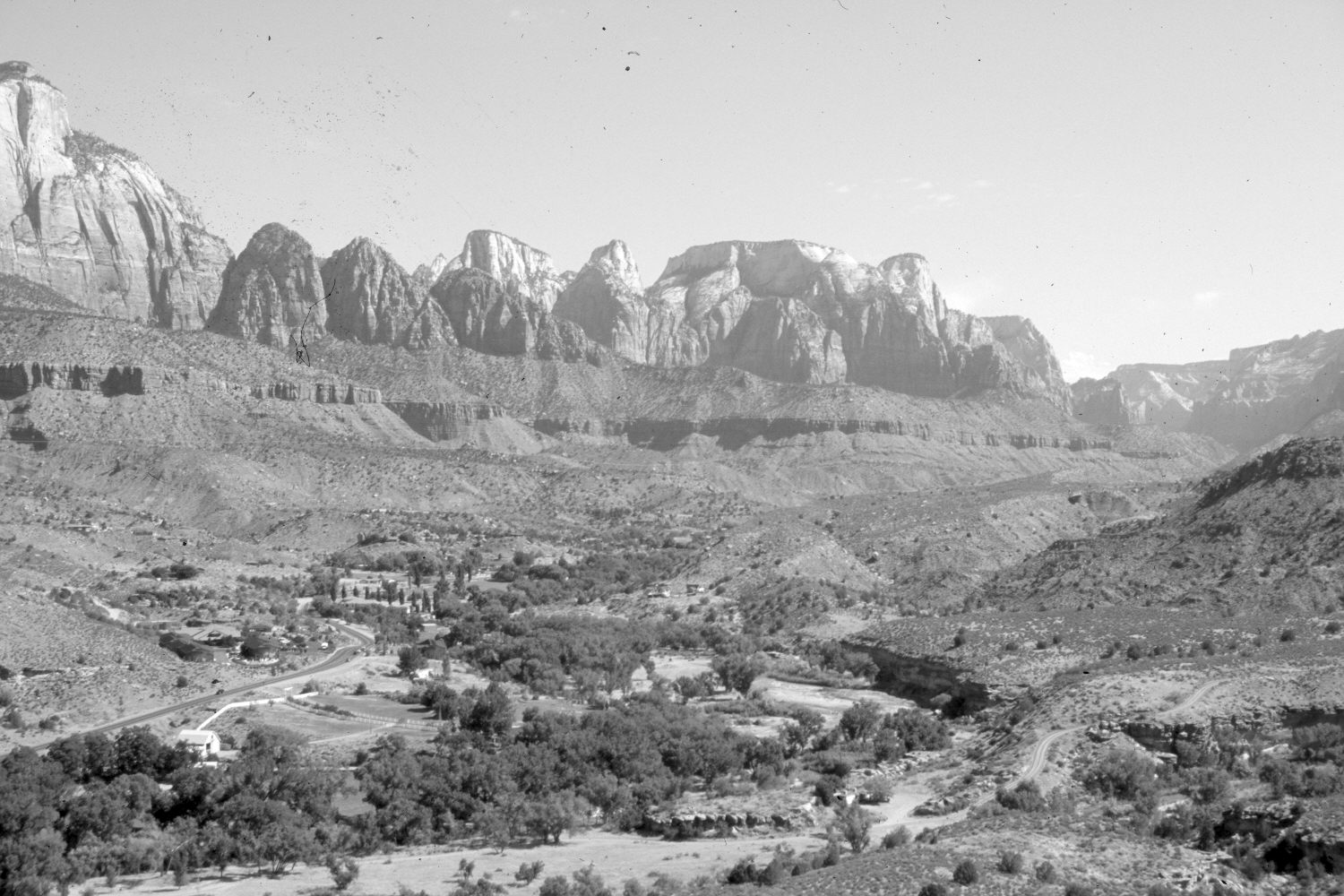
Description:
Plate 1223X. Virgin River 1872 – 2006 Viewed north up the Virgin River from south of Springdale, Utah. The pinyon in the foreground of the 1872 image is still alive but the retake was made 50 feet further to the right to afford an unobstructed view. The East Fork of the Virgin River enters from the right just above the bottom of the photos. Cottonwoods and other woody riparian vegetation have increased along both rivers. Utah Highway 9, on the far side of the Virgin River, has been widened and paved. Agricultural fields and other developments have increased, as have pinyon, juniper, and blackbrush. In the distance is Zion National Park.
Photo Information:
Original photograph taken by John Hillers (No. 80) in 1872; retake by Charles E. Kay on June 9, 2006 - - Photo No. 5648-15. Original photograph held by the U.S. Geological Survey Photographic Library, Denver, CO.
Vegetative Community:
Riparian, Pinyon, Juniper, Black Conifer Brush
Location:
South West: Section 5, Range 10 West, Township 42 South; UTM 321200 E, 4114100 N; elevation 4,160 ft.