Virgin River
1917
2004
Description:
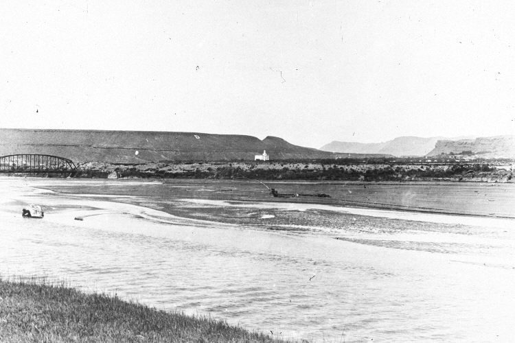
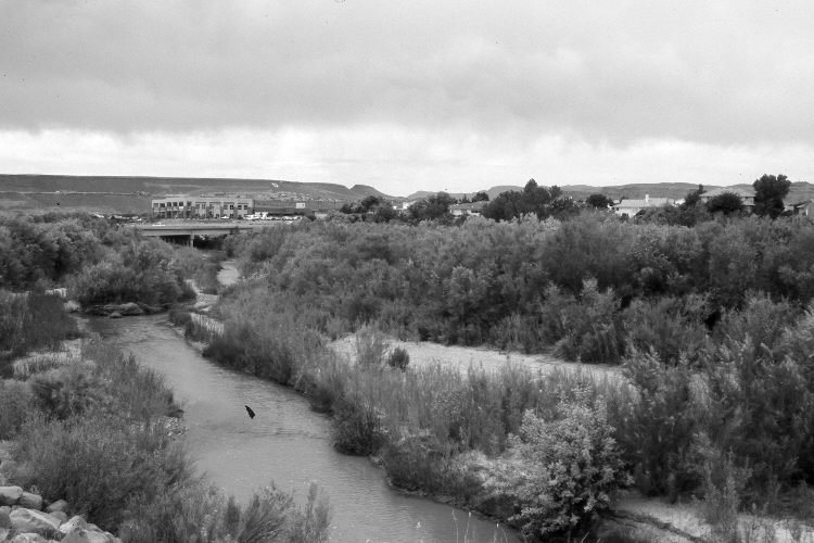
Plate 651X. Virgin River 1917 – 2004 Viewed northwest down the Virgin River at St. George, Utah. The river channel was devoid of woody riparian vegetation in 1917. The white building in the distance is the LDS Temple. The original photopoint is now blocked by a dense growth of riparian vegetation, so the retake was made from the nearest open area. A new bridge has been built across the Virgin River replacing the one that was washed away in January 1990 when Quail Creek Reservoir failed miles upstream. Despite that severe flood, woody riparian vegetation has increased dramatically. Tamarisk, willows, and Russian olive are present. The city has been built to the edge of the river. West Black Ridge is in the distance - - photo left center.
Photo Information:
Original photograph taken ca. 1917; retake by Darrell McMahon on May 7, 2004 - - Photo No. DM-4-22. Original photograph (PH-584, Folder 3, Photo 3) held by the LDS Church Archives, Salt Lake City, UT.
Vegetative Community:
Riparian
Location:
South West: Section 32, Range 15 West, Township 45 South; UTM 273095 E, 4107353 N; elevation 2,537 ft.