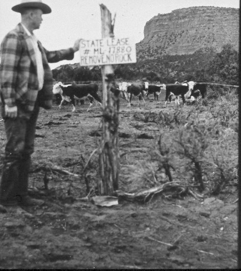
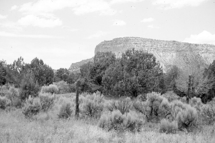
Upper Telegraph Wash
1960
2005
Description:
Plate 877X. Upper Telegraph Wash 1960 – 2005 Viewed northwest to the Vermilion Cliffs in upper Telegraph Wash east of Kanab, UT. Petrified Hollow is to the west. The area behind the fence is state land, while the area in the foreground is managed by BLM. The foreground has been root-plowed to eliminate sagebrush and reseeded with crested wheatgrass. The state land has not been treated. Pinyon and juniper have increased.
Photo Information:
Original photograph taken ca. 1960; retake by Charles E. Kay on June 20, 2005 - - Photo No. 5457-26. Original photograph from Worth Brown’s private collection, Kanab, UT.
Vegetative Community:
Sagebrush, Pinyon, Juniper
Location:
South West: Section 1, Range 4 West, Township 43 South; UTM 393900 E, 4107100 N; elevation 5,750 ft.
January 2018