Upper Sevenmile Valley
1953

1996
Description:
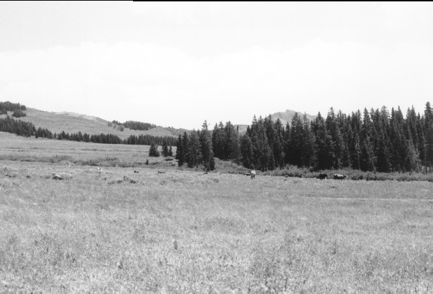
Plate 24. UPPER SEVENMILE VALLEY: 1953 - 1996 This photo point is approximately 100 ft. east of that in Plate 23, but is viewed southeast. Mount Marvine appears on the horizon behind the mid-ground conifers, primarily spruce (Picea sp.), that surround the Mt. Terrill Guard Station. Conifers have increased in height and numbers and willows (Salix spp.) also appear to have increased, although not as much. Silver sage (Artemisia cana) appears unchanged. The road behind the cattle is more visible in 1996 having been rutted and eroded by vehicles.
Photo Information:
1953 photo [#474842] taken on Aug. 12 by the Forest Service; 1996 photo is Kay #4030-35 taken on Aug. 3. Forest Service photo held in the National Agricultural Library, Washington D.C.
Vegetative Community:
Conifer, Riparian, Sagebrush, Wet Meadow
Location:
South Central: Near Mt. Terrill Guard Station, Fishlake N.F., Richfield R.D., T24S, R2E., Sect. 22, UTM 4284900 N, 440400 E; elevation 9,840 ft.; view to southeast.