Upper Lake Stream Basin Mount Holly
1963
2000
Description:
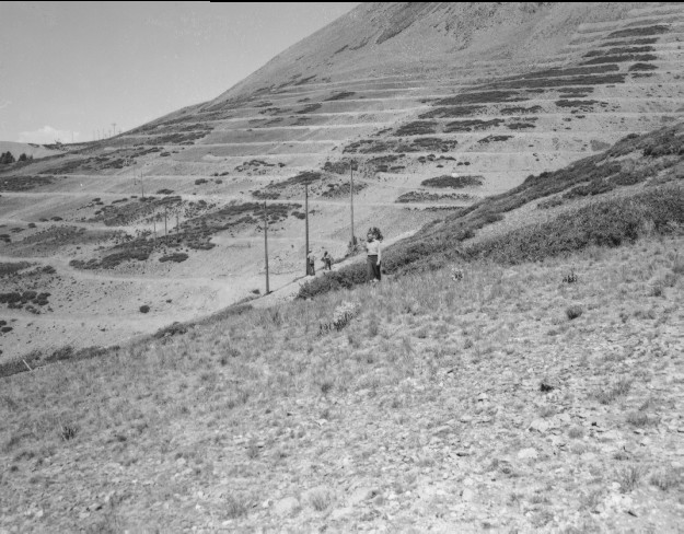
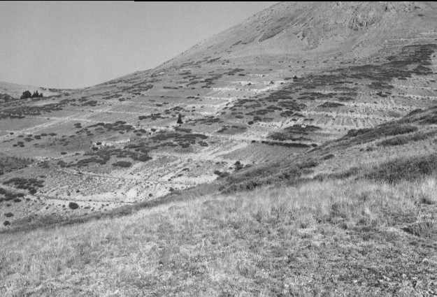
Plate 234. UPPER LAKE STREAM BASIN MOUNT HOLLY 1963-2000 Viewed northwest across the head of Lake Stream basin below Mount Holly. To control erosion into Puffer Lake (Plate 150), the Forest Service gully-plugged, contour-trenched, and reseeded this area. Spruce has increased on this subalpine site and the area is not currently grazed by livestock. The shrubs in the retake are primarily currant (Ribes sp.).
Photo Information:
U.S. Forest Service photo (unnumbered) taken in 1963, the year after the area was treated; retake by Charles E. Kay on August 2, 2000 - - Photo No. 4656-24; Original photo held by Beaver Ranger District, Fishlake National Forest, Beaver, UT.
Vegetative Community:
Conifer, Mountain Brush
Location:
South Central: Section 30, Range 4 W, Township 28 S; UTM 382500 E, 4244850 N; elevation 10,900 ft.