Upper Lake Stream Basin Mount Holly
1962
2000
Description:
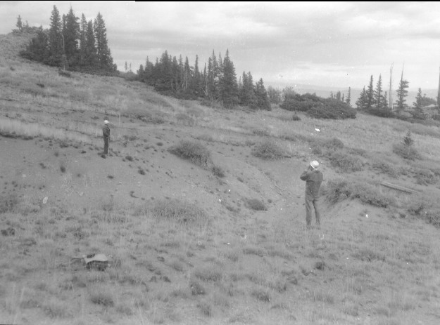
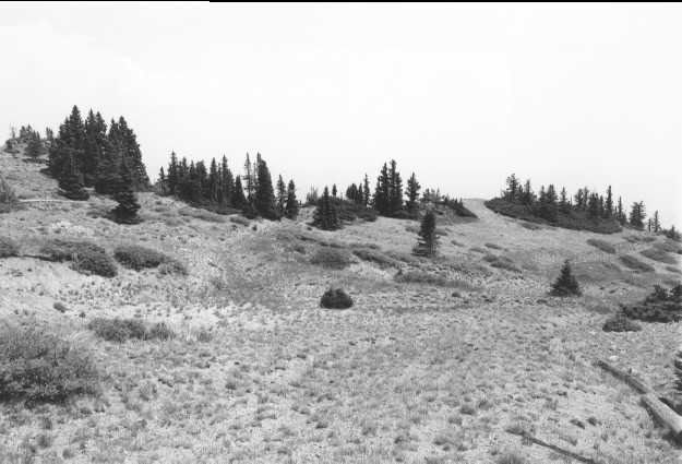
Plate 232. UPPER LAKE STREAM BASIN MOUNT HOLLY 1962-2000 Viewed southeast in upper Lake Stream basin below Mount Holly. The Forest Service gully-plugged, contour-trenched, and reseeded this area to control erosion into Puffer Lake - - see Plate 150. In the original, Forest Service employees are surveying to level the contour-trenches. Spruce has increased on this subalpine site and the area is not currently grazed by livestock. The shrubs are primarily currant (Ribes sp.).
Photo Information:
U.S. Forest Service photo (unnumbered) taken by J.D. Osborn in October 1962; retake by Charles E. Kay on August 2, 2000 - - Photo No. 4656-21; Original photo (2500-B) held by Beaver Ranger District, Fishlake National Forest, Beaver, UT.
Vegetative Community:
Conifer, Mountain Brush
Location:
South Central: Section 29, Range 4 W, Township 28 S; UTM 382600 E, 4244850 N; elevation 10,900 ft.