Upper Kane Creek (2)
1925
1999
Description:
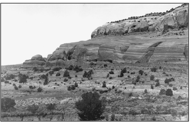
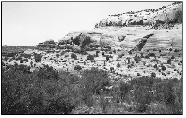
UPPER KANE CREEK 2 This location is approximately 1/4 mile southwest of Hole-in-the-Rock at Kane Springs. The view is west northwest toward Bridger Jack Mesa across public lands administered by the Bureau of Land Management. Two petroleum product pipeline rights-of-way and a 4-wheel access road are in the 1999 scene. The pipelines cross the stream at this point and the road follows the channel downstream for several miles. Many geomorphic and vegetation changes have occurred at this location in the 74 years between photographs. The vertical bank on the far side of the stream visible in the 1925 scene continued to erode into the terrace. A new mid-terrace has been deposited on the near side. A wide variety of multiple aged riparian plants have established across most of the channel width. The active channel has narrowed and is now somewhat stabilized. Some plant species occurring here include Fremont cottonwood, Gooding willow, coyote willow, yellow willow, Russian olive, spikerush, swordleaf rush, Baltic rush, bulrush, common reed, cattail, horsetail, saltgrass, white virgin's bower and a trace of tamarisk. Just to the right of the image there is a 2 foot head cut moving upstream creating an unstable condition at this point. Even though this stream segment cannot be classified as properly functioning, it is in a definite upward trend.
Photo Information:
Photograph Number: Lee No. 3089 Click here to view photograph Original: Date: 1925 (- A) Photographer: W.T. Lee Source: U.S. Geological Survey, Denver, Colorado Retake: Date: May 31, 1999 (- B) Photographer: Earl Hindley Source: San Juan County
Vegetative Community:
Riparian
Location:
San Juan: SW1/4SW1/4 Section 1 T.27S., R.22E.