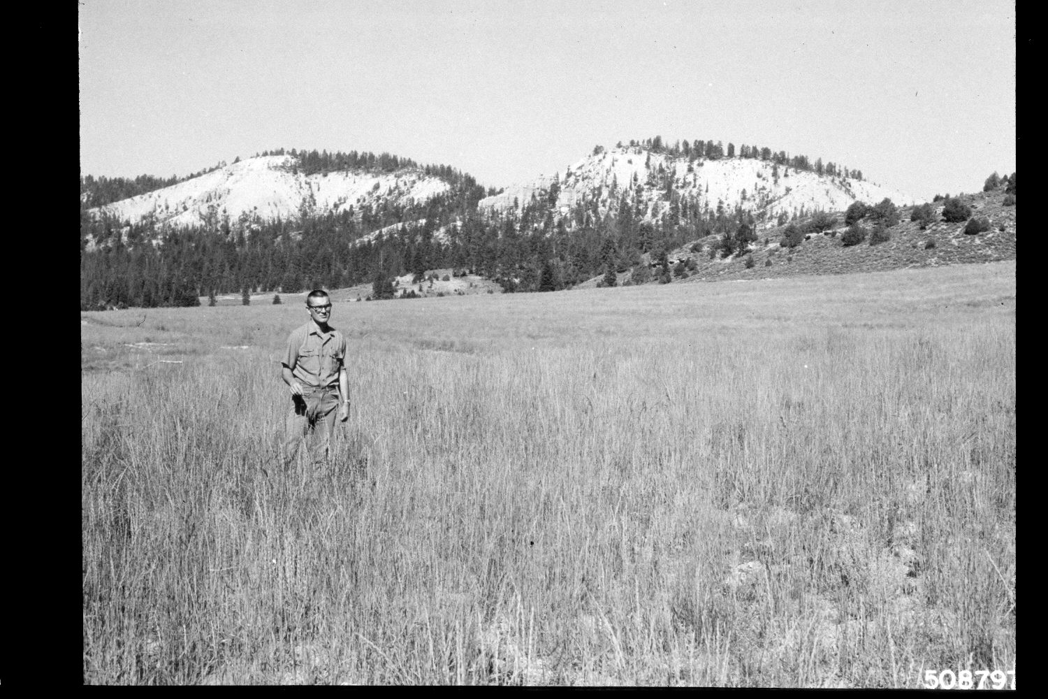
Upper Kanab Creek
1964
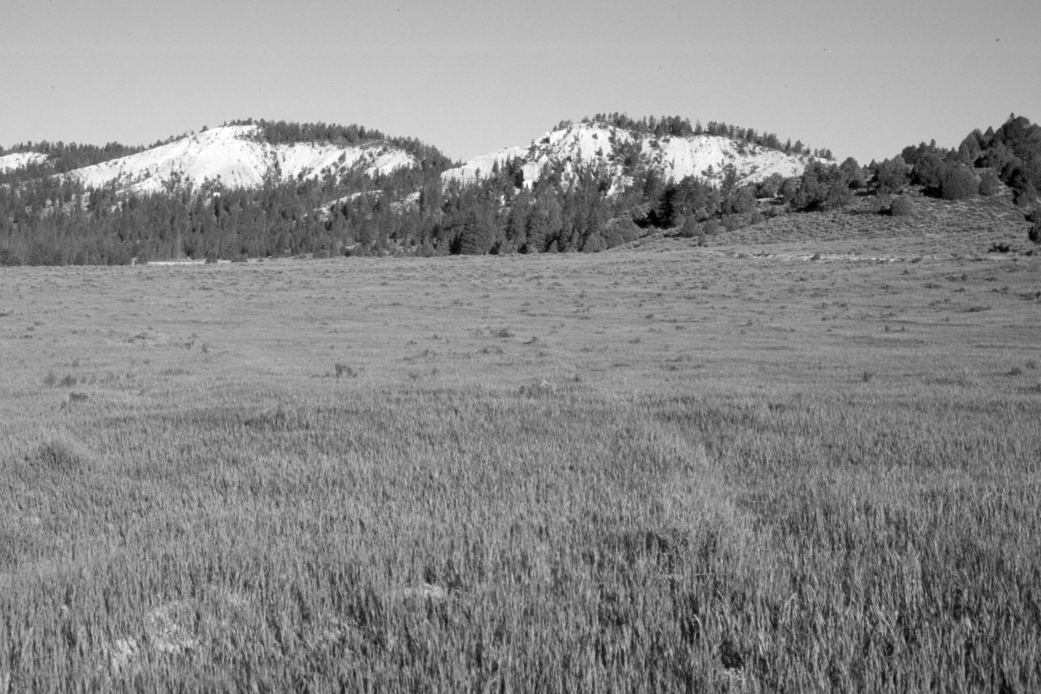
2003
Description:
Plate 248X. Upper Kanab Creek 1964 - 2003 Viewed west up Kanab Creek on the Pausaugunt Plateau. The area was contour-trenched and reseeded with smooth brome in 1962 to control soil erosion. Rubber rabbitbrush has now invaded the planting. Pinyon, juniper, spruce, and ponderosa pine have all increased on the distant hillside. The shrubs above the new road in the retake are mostly mountain big sage. Pictured in the original image is District Ranger Burce Hronek.
Photo Information:
U.S. Forest Service photograph (508797) taken by Lee Prater on August 17, 1964; retake by Charles E. Kay on August 5, 2003 - - Photo No. 5210-14. Original photograph held by the U.S. Forest Service Regional Office Photographic Collection (Dixie-2240-3) housed at Weber State University, Ogden, UT.
Vegetative Community:
Dry Meadow, Pinyon, Juniper, Conifer, Sagebrush
Location:
South West: Section 1, Range 4 ½ West, Township 38 South; UTM 386450E, 4154800N; elevation 8,000 ft.