Upper Cottonwood Creek Pavant Mountains
1960
2000
Description:
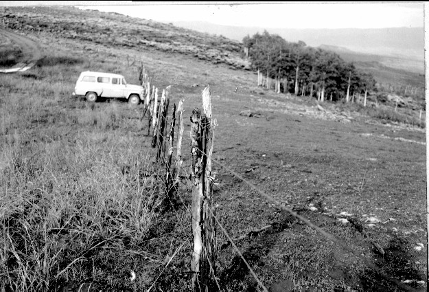
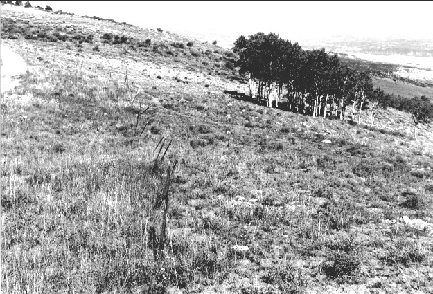
Plate 271. UPPER COTTONWOOD CREEK PAVANT MOUNTAINS 1960-2000 Viewed northeast along the divide between Cottonwood (photo right) and Meadow Creeks (photo left) in the Pavant Mountains. Aspen has not regenerated due to excessive browsing. The barbed wire fence has been replaced with a single-wire electric fence. The shrubs on the distant hillside are snowberry, currant, and big sage.
Photo Information:
U.S. Forest Service photo (unnumbered) ca. 1960; retake by Charles E. Kay on September 2, 2000 - - Photo No. 4679-7A; Original photo (2200 D) held by Fillmore Ranger District, Fishlake National Forest, Fillmore, UT.
Vegetative Community:
Aspen, Mountain Brush, Sagebrush
Location:
South Central: Section 31, Range 3 W, Township 22 S; UTM 392900 E, 4300350 N; elevation 9,620 ft.
January 2018