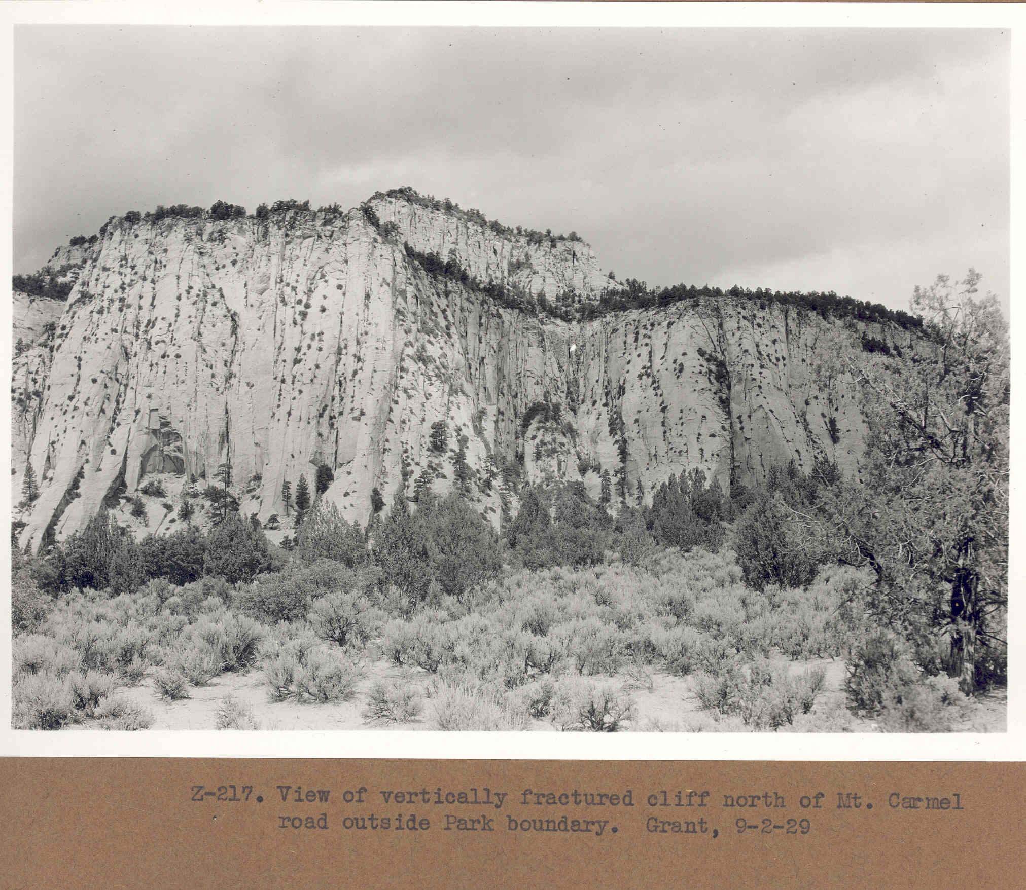
Upper Clear Creek
1929
2006
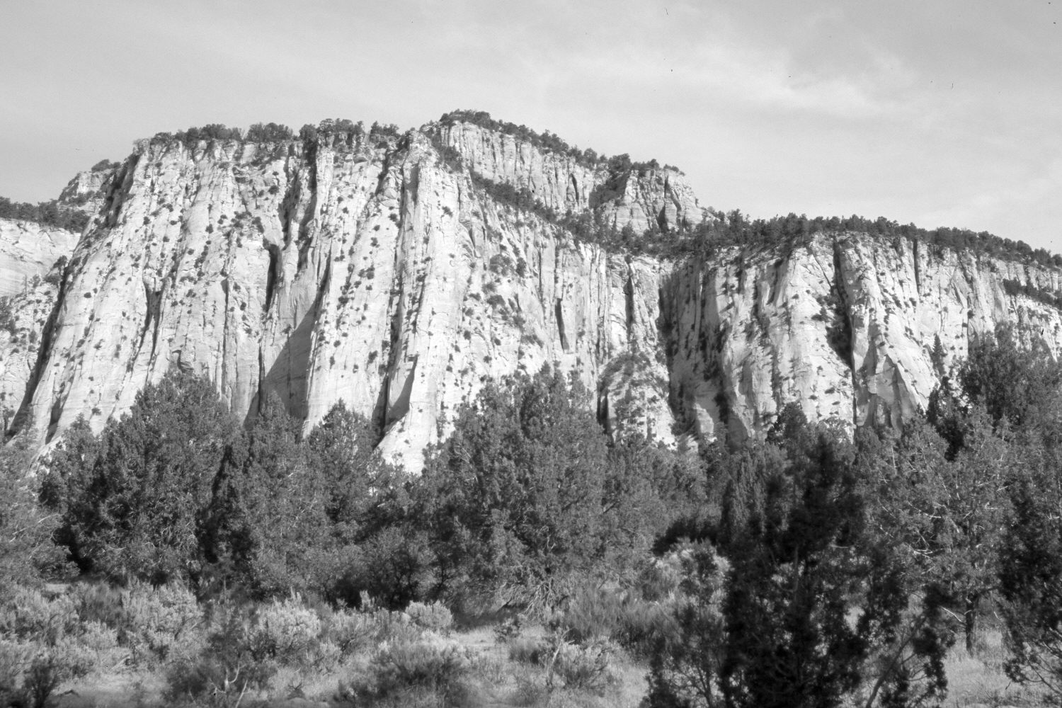
Description:
Plate 1171X. Upper Clear Creek 1929 – 2006 Viewed north to the vertically-fractured cliffs along upper Clear Creek in Zion National Park. The camera station is approximately 300 yards west of the East Entrance. The original photopoint is blocked by a dense growth of pinyon and juniper, so the retake was made from the nearest open area. As pinyon and juniper have increased, sagebrush has declined. Oakbrush too has increased but is largely hidden from view by the dense growth of pinyon and juniper in the retake. Mormon tea, cheatgrass, and green rabbitbrush are also present.
Photo Information:
Original photograph taken by Grant (Z-217) on September 2, 1929; retake by Charles E. Kay on June 3, 2006 - - Photo No. 5625-13. Original photograph (Zion 12366) held by the National Park Service, Zion National Park, Springdale, UT.
Vegetative Community:
Pinyon, Juniper, Sagebrush
Location:
South West: Section 20, Range 9 West, Township 41 South; UTM 333500 E, 4122000 N; elevation 5,680 ft.