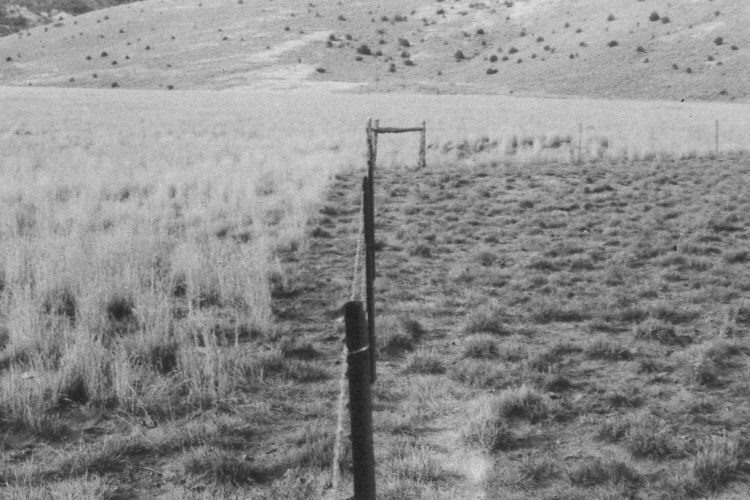
Upper Bear Valley
1967
2005
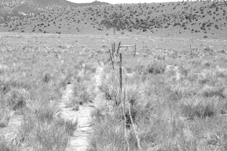
Description:
Plate 903X. Upper Bear Valley 1967 – 2005 Viewed northwest in upper Bear Valley. North Swale is on the extreme left. The area to the right of the fence is private, while the area to the left and behind the fence is part of the Dixie National Forest. Both sides of the fence were root-plowed and planted to crested wheatgrass to eliminate sagebrush and to increase forage production. Rubber rabbitbrush, horsebrush, and sagebrush, however, have reinvaded the treated area. Pinyon, juniper, and sagebrush have increased on the distant hillside - - see Plate 902x. The right side of the fence was more heavily grazed in 1967 than it is today.
Photo Information:
U.S. Forest Service photograph (unnumbered) taken in October 1967; retake by Charles E. Kay on June 24, 2005 - - Photo No. 5468-7. Original photographs, negatives, and narrative reports held in the range files on the Cedar City Ranger District, Dixie National Forest, Cedar City, UT.
Vegetative Community:
Sagebrush, Pinyon, Juniper
Location:
South West: Section 13, Range 6 ½ West, Township 33 South; UTM 360900 E, 4201050 N; elevation 7,460 ft.