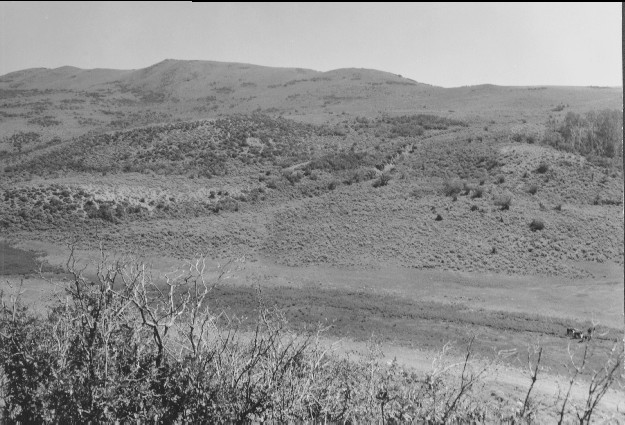
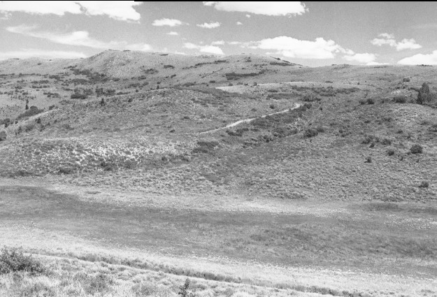
Twin Lakes Panorama
1960
1999
Description:
Plate 52. TWIN LAKES PANORAMA: 1960 - 1999 Plates 51 through 55 form a panorama of Twin Lakes viewed northeast to south. The exact photo point could not be relocated because the 1960 camera station and other parts of the area had been prescribe burned sometime in the 1980's. The area was not as heavily grazed in 1960 as it had been earlier (see Plates 47 - 49), and not as heavily grazed in 1999 as in 1960. Sagebrush (Artemisia tridentata) is common in 1999; most of the dark colored shrubs on the hillside are either serviceberry (Amelanchier alnifolia), chokecherry (Prunus virginiana), snowberry (Symphoricarpos sp.), oak brush (Quercus gambelii), mountain mahogany (Cercocarpus ledifolius), or current (Ribes sp.). Some aspen (Populus tremuloides) has regenerated by 1999, but most has not. The stock trail in the 1960 photo was replaced by a 4x4 track in the 1999 photo.
Photo Information:
1960 photo is U.S. Forest Service [unnumbered] taken on Aug. 3; 1999 photo is Kay #4449-17A, taken on July 25. Forest Service photos held by Fillmore Ranger District, Fishlake national Forest, Fillmore, UT
Vegetative Community:
Ripariand, Mountain Brush, Sagebrush
Location:
South Central: Sargent Mountain, Fishlake N.F, Beaver R.D., T26S, R4½w, Sect. 26, UTM 4264600 N, 384500 E; elevation 8,300 ft., view to east.