Tushar Mountains
1920
2001
Description:
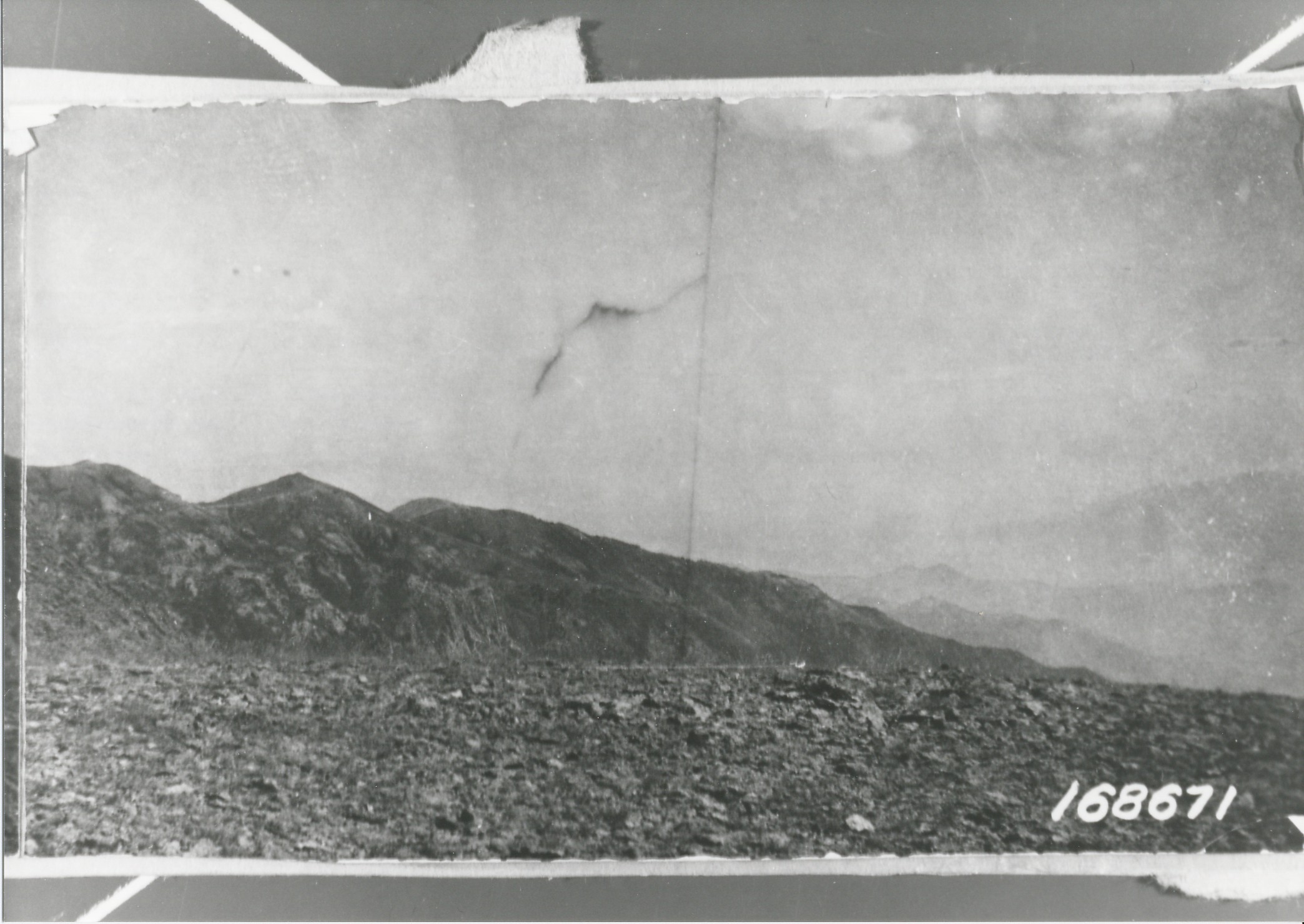
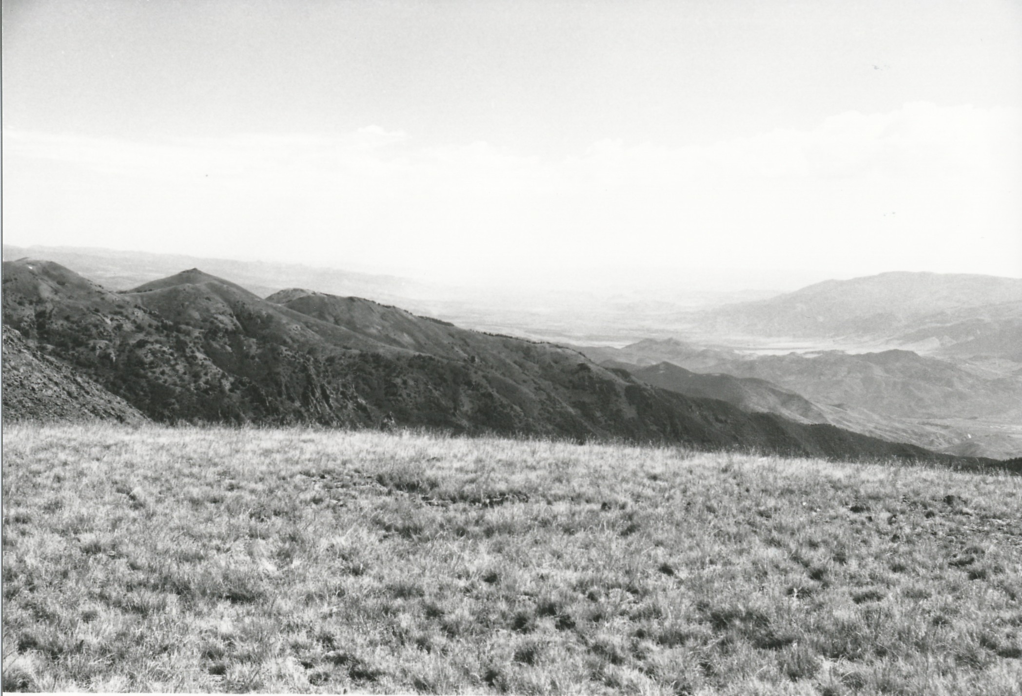
Plate 316. TUSHER MOUNTAINS 1920-2001 Plates 314 to 316 form a panorama from northwest to northeast in the center of the Tusher Mountains. Plate 316 is viewed northeast to Copper Belt Peak (11,383 ft) and Beecher Ridge above Bullion Canyon. The Sevier River Valley is in the distance. The area no longer is grazed by domestic sheep and plant cover in the foreground has increased. Douglas fir, aspen, and curlleaf mountain mahogany occupy the south-facing slopes on Beecher Ridge.
Photo Information:
U.S. Forest Service photo 168671 ca. 1920; retake by Charles E. Kay on August 8, 2001 - - Photo No. 4866-4; Original photo (2310-Fishlake-53) held by the Forest Service Regional Office Photographic Collection housed at Weber State University, Ogden, UT.
Vegetative Community:
Conifer, Aspen, Mountain Brush
Location:
South Central: Section 13, Range 5 W, Township 28 S; UTM 379600 E, 4249550 N; elevation 11,826 ft.