Tushar Mountains
1920
2001
Description:
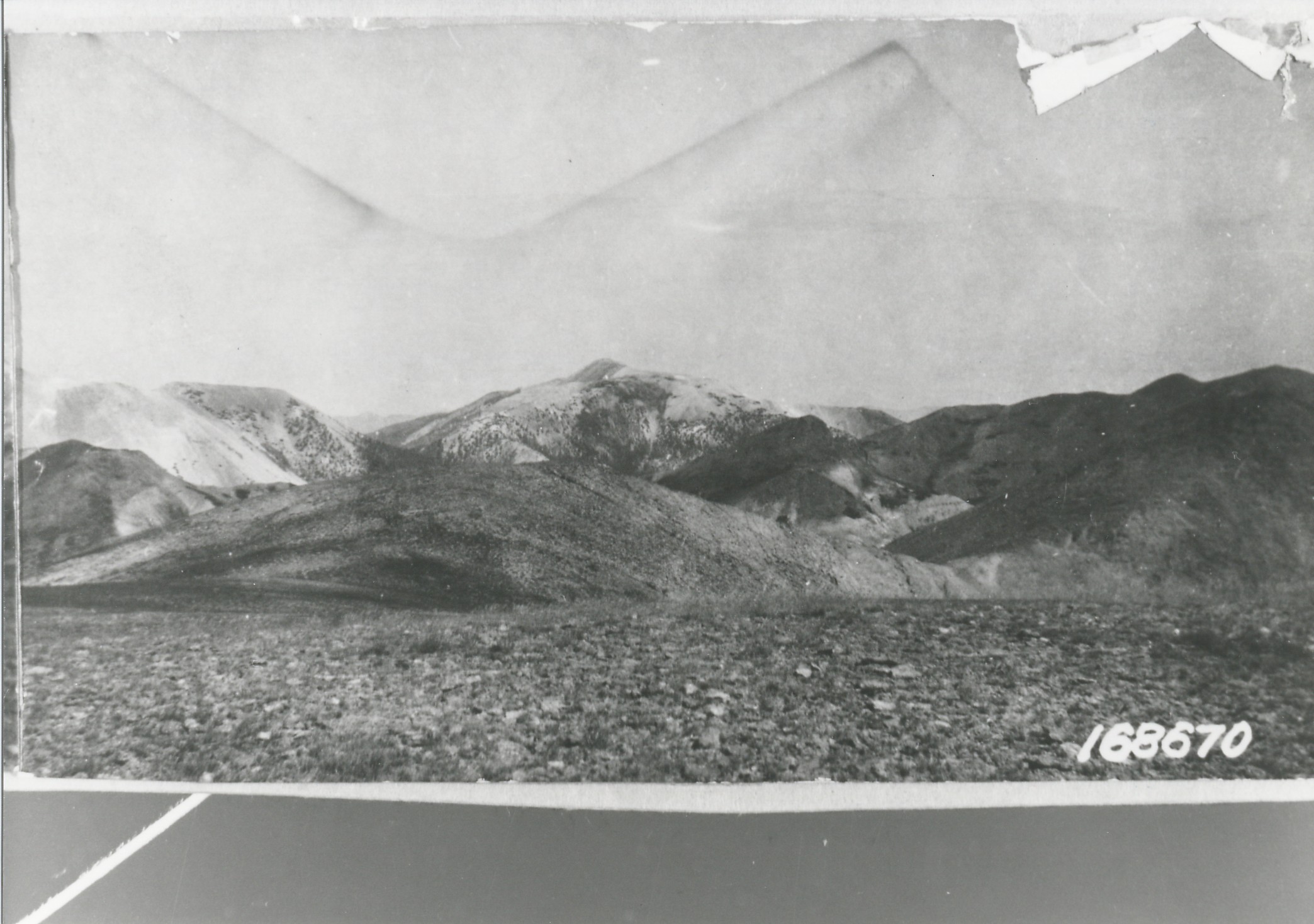
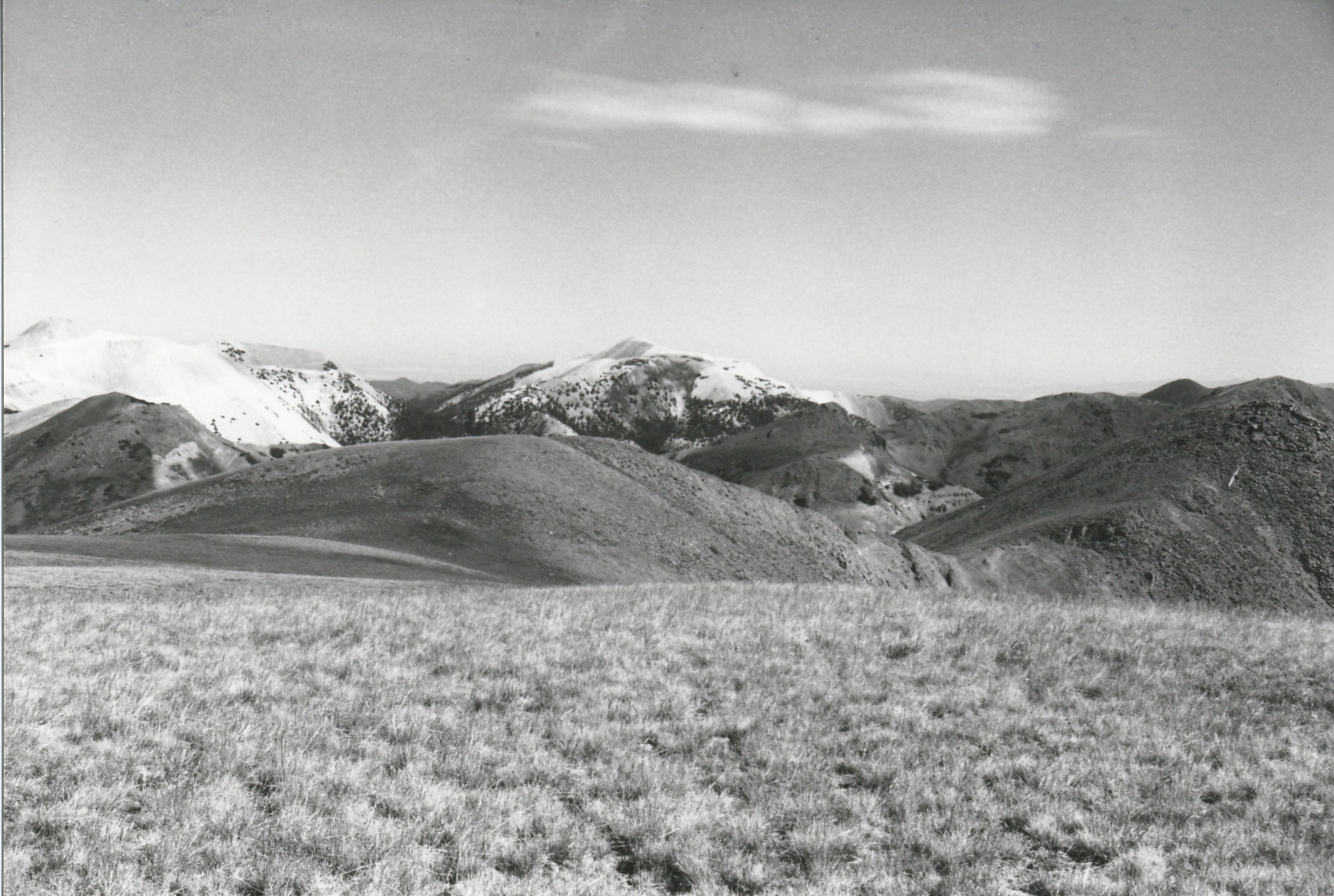
Plate 315. TUSHER MOUNTAINS 1920-2001 Plates 314 to 316 form a panorama from northwest to northeast in the center of the Tusher Mountains. Plate 315 is viewed north over the head of Pine Creek to Gold Mountain (11,650 ft). The area no longer is grazed by domestic sheep and plant cover in the foreground has increased. Conifers, primarily spruce, have increased in height and numbers, but treeline appears unchanged. Cat trails and other mining activity are visible in the retake.
Photo Information:
U.S. Forest Service photo 168670 ca. 1920; retake by Charles E. Kay on August 8, 2001 - - Photo No. 4866-2; Original photo (2310-Fishlake-53) held by the Forest Service Regional Office Photographic Collection housed at Weber State University, Ogden, UT.
Vegetative Community:
Conifer
Location:
South Central: Section 13, Range 5 W, Township 28 S; UTM 379600 E, 4249550 N; elevation 11,826 ft.