Turner Water Canyon
1927
1999
Description:
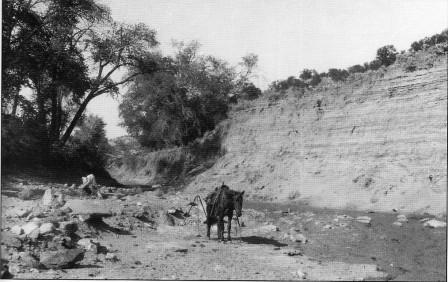
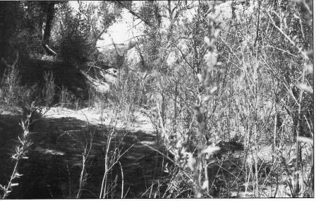
TURNER WATER CANYON This downstream view of Turner Water Canyon is about one mile from its head. The view area is public land administered by the Bureau of Land Management. This channel segment has improved with establishment of a good variety of riparian vegetation in response to an intermittent surface flow that is apparently augmented with subsurface free water. The right vertical bank, visible in the 1927 photograph, has eroded back nearly to bedrock, the active channel has narrowed and aggraded slightly. Riparian vegetation consisting of narrowleaf, Fremont, and lanceleaf cottonwoods, coyote willow, yellow willow, water birch, bulrush, Baltic rush, and white virgin's bower has established across the entire developing floodplain. A few tamarisk plants can also be found at this site. From this point downstream, cottonwood trees decrease, but willow populations continue for about .3 mile where they too decrease as the influence of subsurface water diminishes.
Photo Information:
Photograph Number: Goldman No.370 Original: Date: May 21, 1927 (- A) Photographer: M.I. Goldman Source: U.S. Geological Survey, Denver, Colorado Retake: Date: May 31, 1999 (- B) Photographer: Earl Hindley Source: San Juan County
Vegetative Community:
Riparian
Location:
San Juan: SW1/4NE1/4 Section 35 T.31S., R.22E.