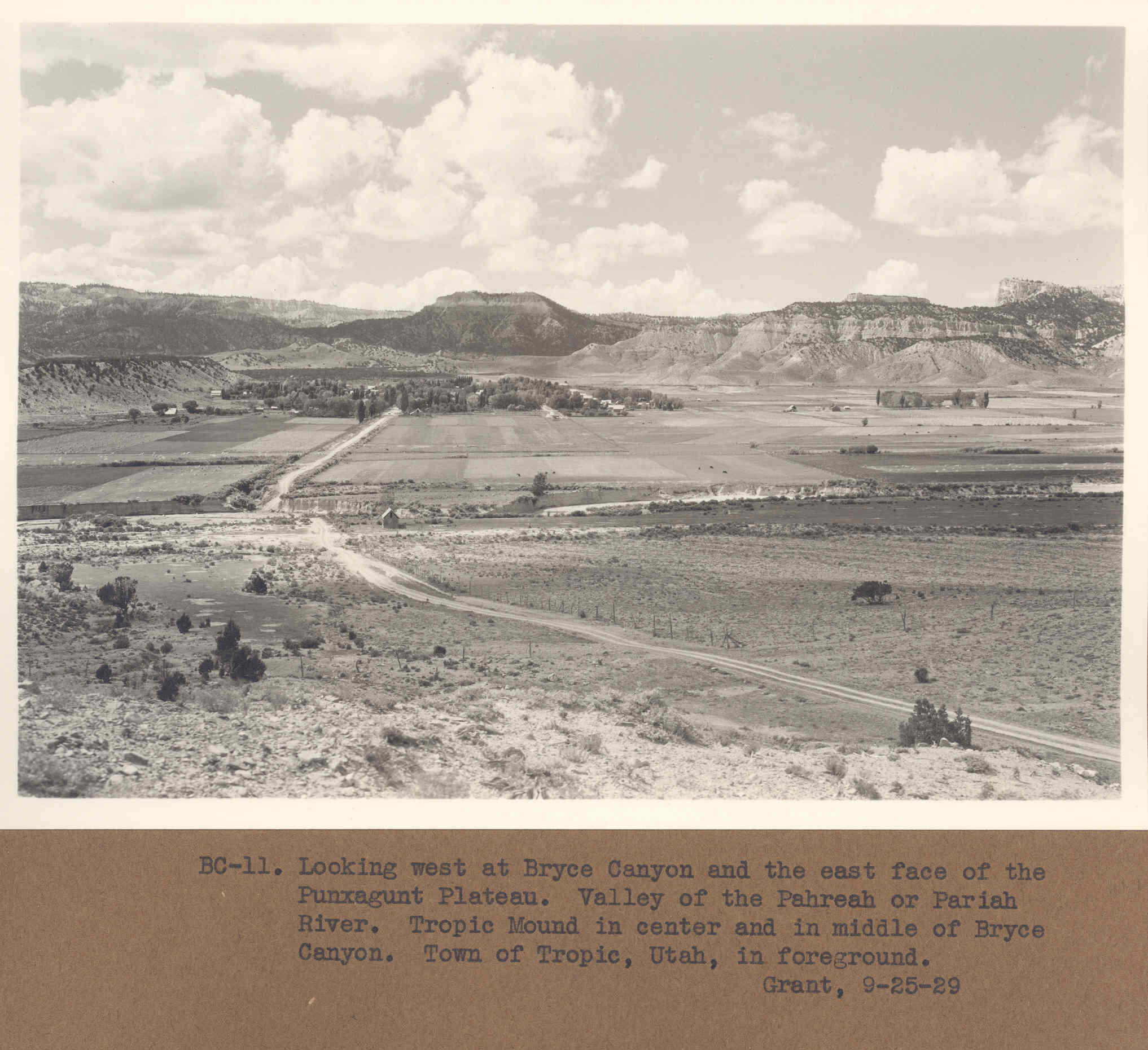
Tropic Valley
1929
2006
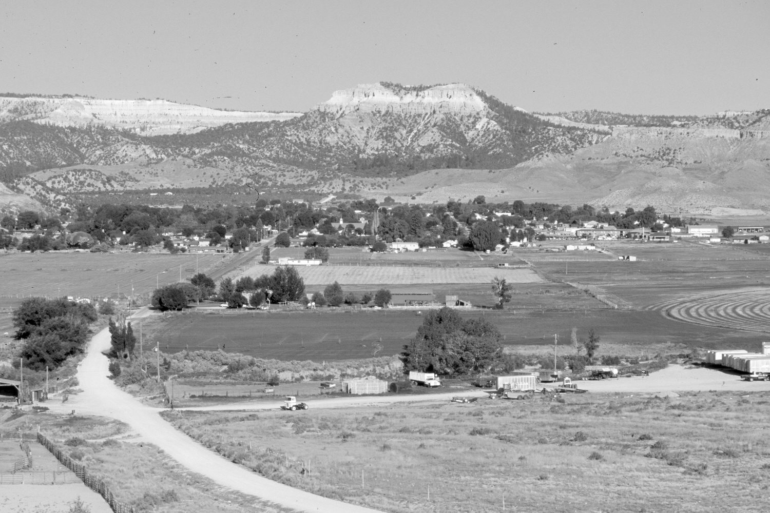
Description:
Plate 1270X. Tropic Valley 1929 – 2006 Viewed west to Tropic, Utah. Bryce Canyon National Park is in the distance. Bristlecone Point (7,796 ft) is on the skyline behind the town. The Paria River flows from right to left and is more incised today than in the past. Woody riparian vegetation, however, has increased. Settlement patterns have changed on the privately owned land in the valley. Pinyon and juniper have increased.
Photo Information:
Original photograph taken by Grant (BC-11) on September 25, 1929; retake by Charles E. Kay on June 24, 2006 - - Photo No. 5665-33. Original photograph (Zion 12366) held by the National Park Service, Zion National Park, Springdale, UT.
Vegetative Community:
Riparian, Pinyon, Juniper
Location:
South West: Section 36, Range 3 West, Township 36 South; UTM 406300 E, 4164450 N; elevation 6,300 ft.