Tri-County Line
1962
2000
Description:
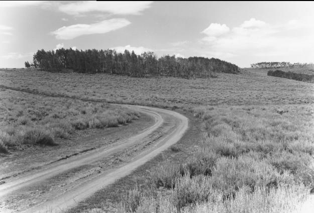
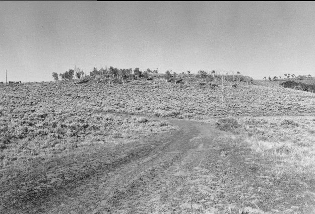
Plate 194. TRI-COUNTY LINE 1962-2000 Viewed southwest near the Sevier, Piute, and Wayne county lines. The fence (photo left center edge) in the original and retake is the Fishlake National Forest boundary. Of the four aspen clones in the original, three have declined markedly and none has regenerated due to excessive browsing. The road alignment (USFS 046) has changed and the track pictured in the original is no longer the main road. In the retake, there also is an ATV trail that turns right and goes down the drainage. A powerline has been added to service a housing development (Aspen Estates) to the south. Sagebrush appears unchanged.
Photo Information:
U.S. Forest Service photo (unnumbered) taken in 1962; retake by Charles E. Kay on July 28, 2000 - - Photo No. 4640-7A. Original photo held by the Loa Ranger District, Fishlake National Forest, Loa, UT.
Vegetative Community:
Aspen, Sagebrush
Location:
South Central: Section 35, Range 1 E, Township 26 S; UTM 433000 E, 42614000 N; elevation 8,760 ft.