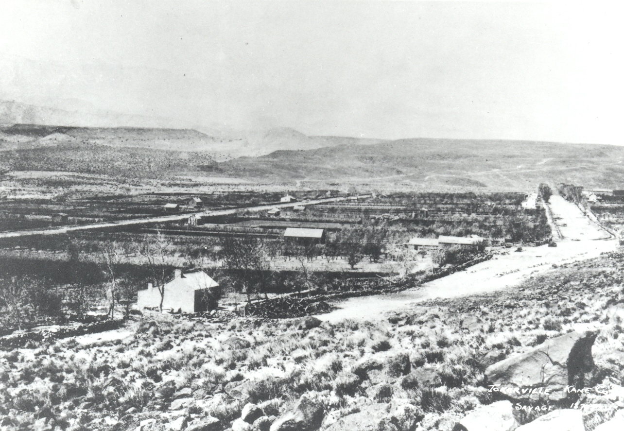
Toquerville, Utah
1870
2006
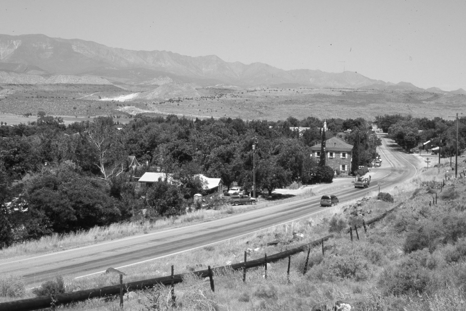
Description:
Plate 1233X. Toquerville, Utah 1870 – 2006 Viewed north-northwest down Utah Highway 17 in Toquerville, Utah. The road has been realigned and paved. The Pine Valley Mountains are in the distance. Pinyon and juniper have increased. The townsite is more wooded today than in the past.
Photo Information:
Original photograph taken ca. 1870; retake by Charles E. Kay on June 10, 2006 - - Photo No. 5651-29. Original photograph (Zion 10531) held by the National Park Service, Zion National Park, Springdale, UT.
Vegetative Community:
Pinyon, Juniper
Location:
South West: Section 2, Range 13 West, Township 41 South; UTM 297500 E, 4124500 N; elevation 3,400 ft.
January 2018