Tippets Valley
1941
2005
Description:
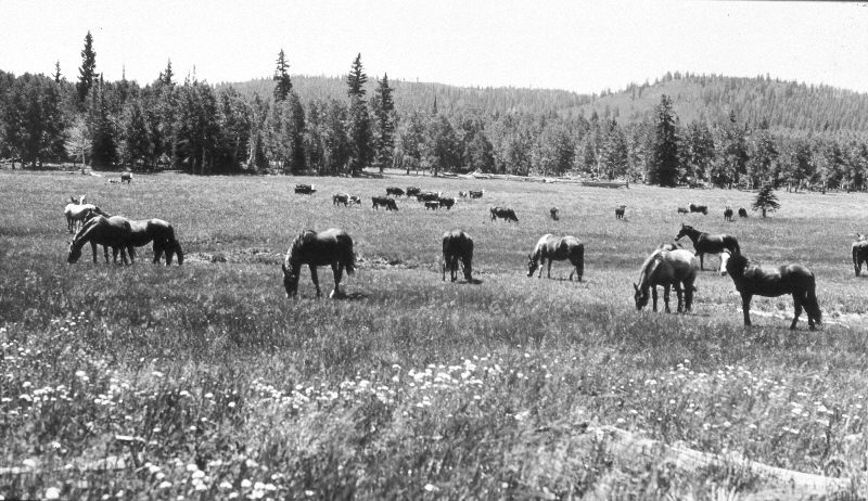
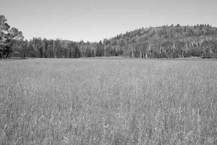
Plate 1113X. Tippets Valley 1941 – 2005 Viewed southwest across Tippets Valley. A spring is located just off the photos to the right. The meadow has been root-plowed and reseeded with smooth brome - - see Plate 1112X. The area was actively being grazed by cattle in 2005. The wooden sheep corral seen in the center of the 1941 image is the location for Plates 1116x and 1117X. In the distance, aspen has declined, while spruce, Douglas fir, ponderosa pine, and white fir have increased. A few aspen stands regenerated 30 years ago when mule deer numbers were low, but not before or since due to repeated ungulate browsing (Kay and Bartos 2000).
Photo Information:
U.S. Forest Service photograph (unnumbered) taken on August 2, 1941; retake by Charles E. Kay on September 2, 2005 - - Photo No. 5546-30A. Original photograph held by Southern Utah University Archives and Special Collections, Cedar City, UT.
Vegetative Community:
Dry Meadow, Conifer, Aspen
Location:
South West: Section 23, Range 8 West, Township 37 South; UTM 348550 E, 4160200 N; elevation 9,050 ft.