Threemile Chaining
1976
2005
Description:
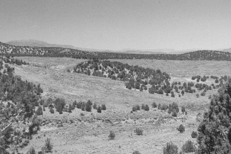
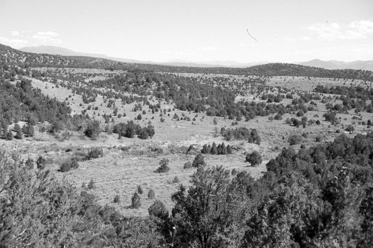
Plate 1161X. Threemile Chaining 1976 – 2005 Viewed northeast over Threemile Creek northwest of Panguitch, Utah. The original photopoint is now blocked by pinyon and juniper, so the retake was made from the nearest open area. Much of the area was chained in 1975 and planted with crested and intermediate wheatgrass. Pinyon and juniper, however, have begun to invade the treated area. Willows appear to have increased along Threemile Creek. The area was grazed by cattle in 2005.
Photo Information:
U.S. Forest Service photograph (unnumbered) taken on June 24, 1976; retake by Charles E. Kay on September 7, 2005 - - Photo No. 5572-5. Original photographs, negatives, and narrative reports held in the range files on the Cedar City Ranger District, Dixie National Forest, Cedar City, UT.
Vegetative Community:
Pinyon, Juniper, Dry Meadow, Riparian
Location:
South West: Section 10, Range 6 West, Township 34 South; UTM 366600 E, 4191775 N; elevation 7,250 ft.