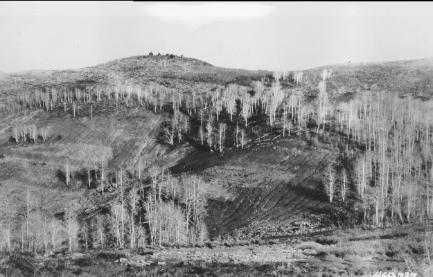
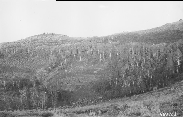
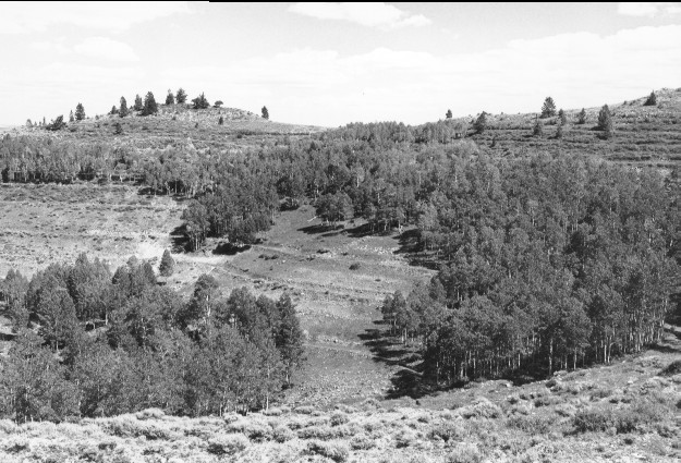
White Pine Creek
1921
1945
1999
Description:
Plate 126 WHITE PINE CREEK: 1921 - 1945 - 1999 The view is to the head of White Pine Creek. This plate forms a panorama with Plate 125 from east to northeast. The 1921 photo was taken in the spring when aspen (Populus tremuloides) was leafless. Aspen regeneration is present in both the 1921 and 1945 photos, but not in the 1999 photo. Soil erosion was widespread in the two early photos, but then the site was contour trenched, gully-plugged, and seeded. The area is just above a spring and consequently was heavily grazed by cattle in 1999. Conifers appear to have increased in abundance along the distant ridge. The Forest Service trail in the two earlier photos is now the main access road.
Photo Information
1921 photo #468727 and 1945 photo #468723 were taken by the U.S. Forest Service; 1999 photo taken by Kay #4496-11 on Sept. 6. Forest Service photos [2520-Fishlake-2 and 2200-Fishlake-18] held by the Forest Service Regional Office Photographic Collection housed at Weber State Univ., Ogden, UT.
Vegetative Community:
Aspen, Conifer, Sagebrush
Location:
South Central: Pavant Mountains, Fishlake National Forest, Fillmore Ranger District; T22S, R3W, Sect. 32, UTM 4301600 N, 395300 E; elevation 9,250 ft., viewed to northeast.