West Fork Of Hunt Creek
1946
1953
1959
Description:
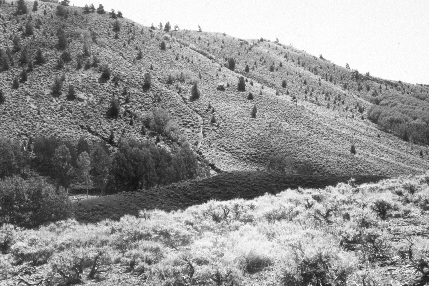
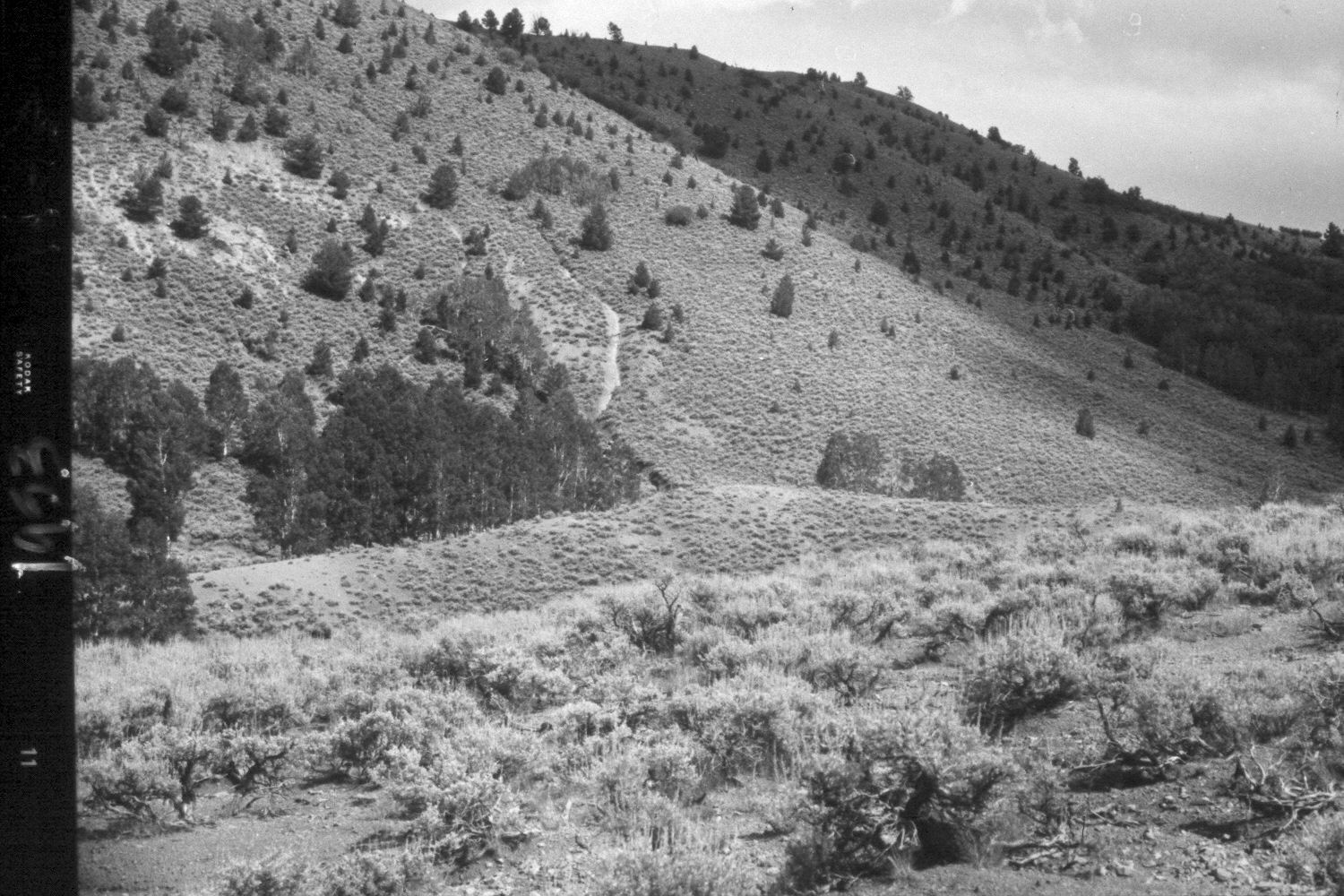
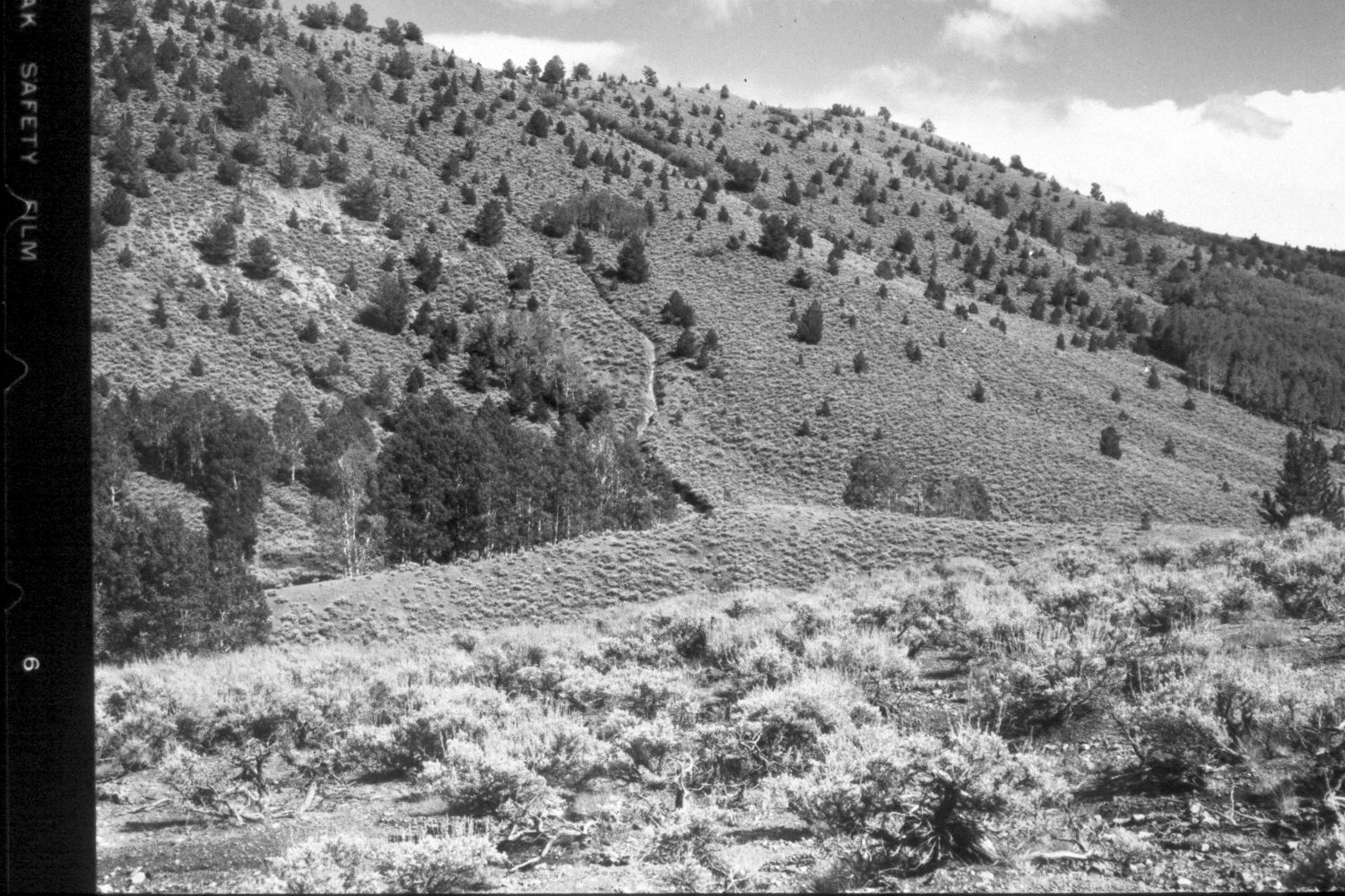
Plate 175X. West Fork of Hunt Creek 1946 - 1953 - 1959 - 2003 The Photo Plot Transect on the West Fork of Hunt Creek was established in 1943 and reread in 1946, 1953, and 1959. Initial range conditions were described as very poor and all plant communities were heavily grazed by cattle and domestic sheep. According to early narrative reports, “the most noticeable thing…was the amount of dead willows. The creek bottom was formally covered [with willows] in all the little openings that we traversed from the head of the creek. Now [1943] most of them are dead….it may [also] be stated that the creek has cut down a deep channel and is still cutting during heavy runoffs…grasses are quite scarce.” In 1953, it was noted that “sheet and gully erosion [were] severe, not only at the transect site but from lower West Hunt Creek to [its] head…small recent alluvial deposits [were] common all along the transect…Existing gullies have been deepened considerably and some new ones formed…[even in the] aspen type sheet erosion is a real problem.” After remeasuring the transect in 1959, Range Conservationist I.H. Johnson noted that, “There is nothing from the analysis of transect records to give assurance that this range is on the mend. On the contrary, the data points very definitely to a continuation of the down trend for both vegetation and soil that was previously reported…” (unpublished reports in range files, Panguitch Ranger District, Panguitch, UT). Plate 175x is viewed southeast from the end point (plot D-239) of the transect. The West Fork of Hunt Creek is at the base of the far hillside. Conifers, primarily limber pine and Douglas fir, had increased dramatically, but many were killed by the Sanford fire in 2002. Sagebrush in the foreground and on the distant hillside was also consumed by the Sanford fire, which burned large portions of this drainage. Aspen has declined and has not successfully regenerated in many years due to repeated browsing of aspen suckers by deer, elk, and livestock. The erosional gully seen in the earlier photos has stabilized and naturally revegetated. Soil erosion is now uncommon except on severely burned hillsides, where recent summer storms have triggered debris flows and flash floods.
Photo Information
U.S. Forest Service photographs (unnumbered) taken by Walter Cottam on August 23, 1946; I.H. Johnson on August 10, 1953; and I.H. Johnson on August 19, 1959; retake by Charles E. Kay on July 12, 2003 - - Photo No. 5184-12. Original photographs, negatives, and narrative reports held in the range files on the Panguitch Ranger District, Dixie National Forest, Panguitch, UT.
Vegetative Community:
Riparian, Aspen, Conifer
Location:
South West: On both the USGS 1:24,000 Adams Head (1971) topographic map and the 1995 Dixie National Forest map, this area has not been surveyed, thus there is no Section, Range, or Township; UTM of transect starting point 393150E, 4195500N; elevation 8,960 ft.