Upper Kanab Creek
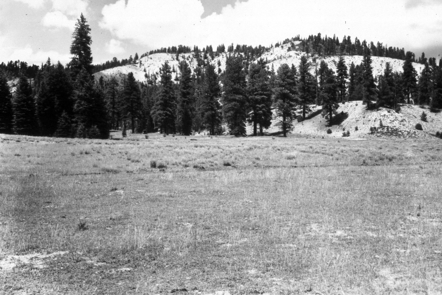
1946
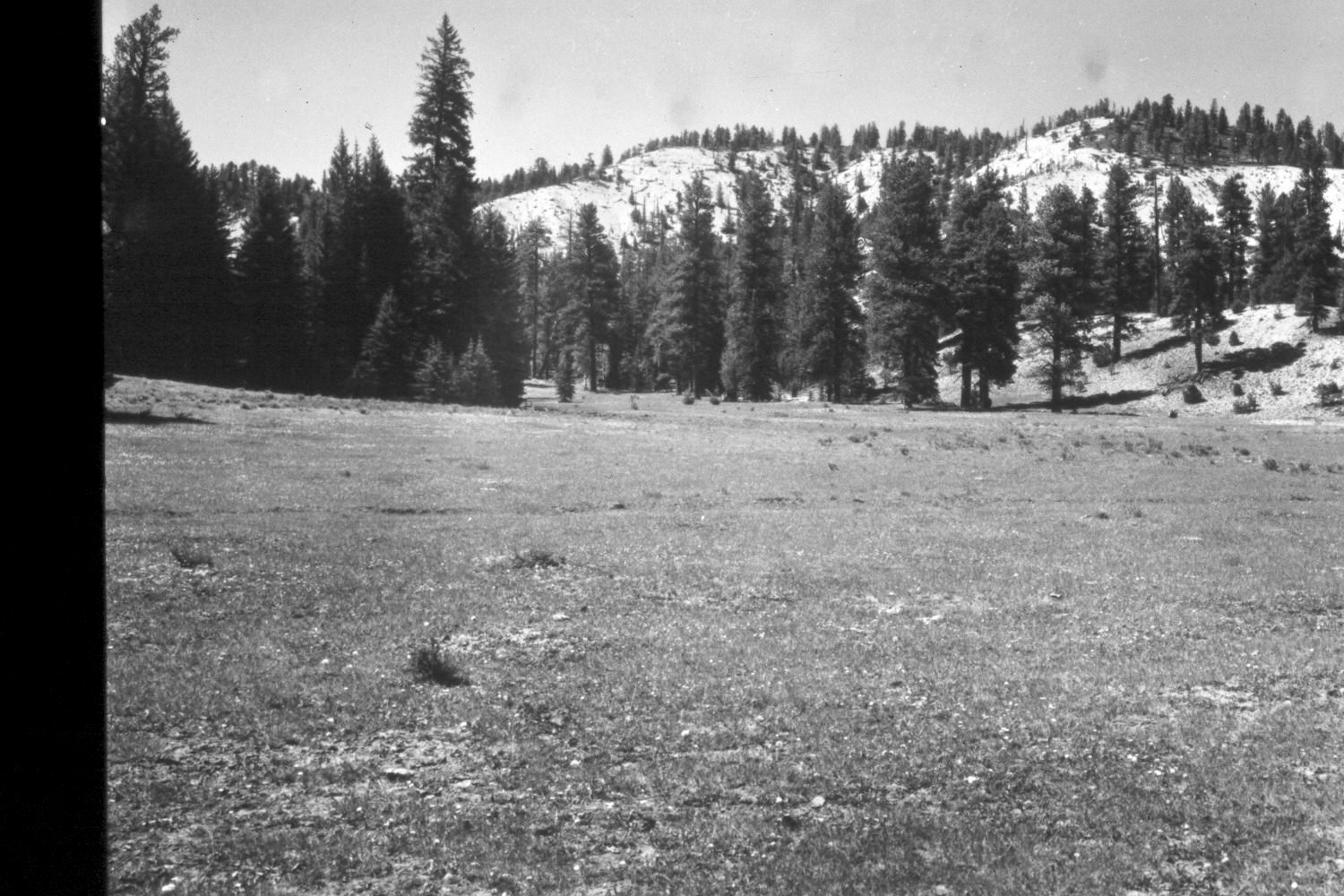
1953
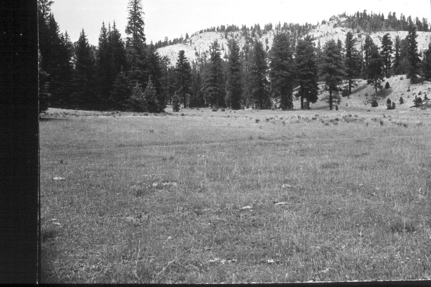
1961
Description:
Plate 252X. Upper Kanab Creek 1946-1953-1961-1979-2003 The Upper Kanab Creek Photo Plot Transect was established in 1943 and reread in 1946, 1953, 1961, and 1979. The transect was set-up with two legs starting at a common point near a large ponderosa pine. The first line runs 950 feet in a southerly direction, while the second leg runs 300 feet in a westerly direction. Initial range conditions were described as poor with a downward trend. “The more desirable grasses are scarcely holding their own. Kentucky bluegrass is gaining ground on the former dry meadow and the less desirable and worthless forbs have increased considerably.” Rabbitbrush and snakeweed (Gutierrezia sarothrae) were described as increasing and a “further indication of a downward trend.” Bare soil areas were described as “excessive” and “dense erosion pavement [was] conspicuous.” Despite a change from joint use by domestic sheep and cattle to a cattle only allotment, the range trend was still considered down in 1961. During the early 1970’s, the upper part of the transect was logged and “the soil severely disturbed.” The Forest Service also built a new road across the center of the longest leg of the transect. Nevertheless, in 1979 Dr. Jim Bowns, range ecologist at Southern Utah University, noted that range conditions had improved to “high fair to low good with an upward trend” (unpublished reports in the range files on the Panguitch Ranger District, Dixie National Forest, Panguitch, UT). Plate 252x is viewed north from the southern end of the longest transect leg back to the transect starting point. Note the new road that has been built by the Forest Service and how the old road nearer the camera has revegetated. Many of the largest trees were logged during the early 1970’s. Nevertheless, ponderosa pine, spruce, and juniper have all increased. Shrubby cinquefoil has increased in the foreground, but elsewhere grass cover appears to have increased, despite the continued drought. The foreground is mostly Kentucky bluegrass, while needle and thread becomes more common as one progresses north along the transect. The area had not been grazed by livestock when it was rephotographed in 2003.
Photo Information
U.S. Forest Service photographs (unnumbered) taken by Walter Cottam on August 20, 1946; I.H. Johnson on June 23, 1953; I.H. Johnson on August 3, 1961; and Jim Bowns and Al Tait on July 20, 1979; retake by Charles E. Kay on August 5, 2003 - - Photo No. 5210-21. Original negatives, photographs, and narrative reports held in the range files on the Panguitch Ranger District, Dixie National Forest, Panguitch, UT.
Vegetative Community:
Conifer, Dry Meadow, Juniper
Location:
South West: Section 10, Range 4 ½ West, Township 38 South; UTM of the transect starting point 383150E, 4152800N; elevation 8,150 ft.