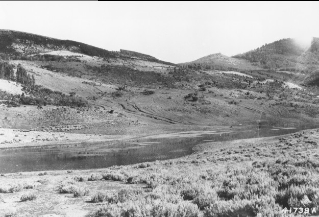
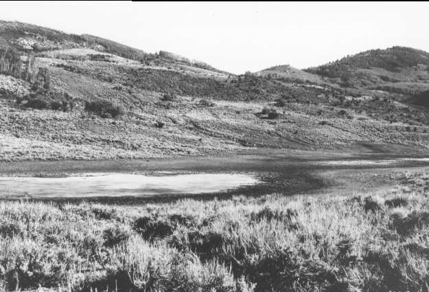
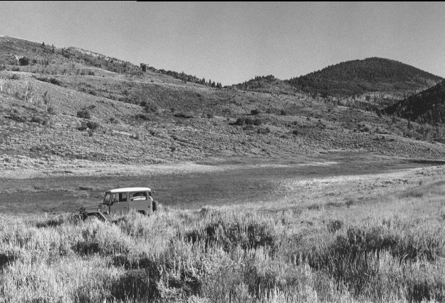
Twin Lakes
1919
1943
1999
Description:
Plate 49. TWIN LAKES: 1919 - 1943 - 1999 Grazing was very heavy in 1919 and active erosion gullies were common, especially behind the lakes. The lake beds still showed heavy utilization in 1943, but sagebrush (Artemisia tridentata) had increased and soil erosion had ceased. Also, aspen (Populus tremuloides) had increased in height and several stands had regenerated. Both lakes held water in 1999 which was obscured by a dense growth of emergent vegetation, primarily sedges (Carex spp.) and shrubs. Grasses appeared more common and sagebrush had declined by 1999, especially in areas prescribe burned 10 to 15 years earlier. A 4x4 road replaces the original stock trail. Note the dam on the far southern shore (right edge of 1999 photo) of the lower lake. Most of the dark colored low growing shrubs are snowberry (Symphoricarpus sp.), the taller shrubs are serviceberry (Amelanchier alnifolia ) with a small amount of oak brush (Quercus gambelii). All eroded areas naturally revegetated by 1999 despite continued livestock grazing.
Photo Information:
Sargent Mountain, Fishlake N.F, Beaver R.D., T26S, R4½w, Sect. 23, UTM 4265800 N, 384500 E; elevation 8,060 ft., view to south.
Vegetative Community:
Riparian, Aspen, Sagebrush
Location:
South Central: 1919 photo is U.S. Forest Service #41739A taken on Aug. 6; 1943 photo is U.S. Forest Service #468730 taken on Aug. 30; 1999 photo is Kay #4446-28, taken on July 24. Forest Service photos held in U.S.F.S. Regional Office Photographic Collection housed at Weber State Univ. Ogden UT.