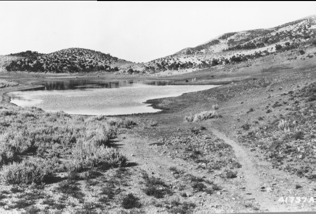
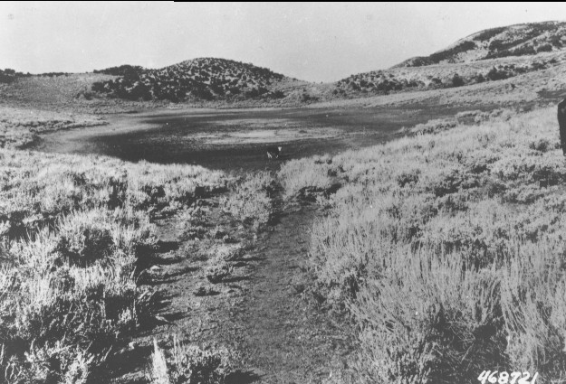
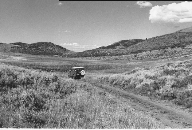
Twin Lakes
1919
1945
1999
Description:
Plate 47. TWIN LAKES: 1919 - 1945 - 1999 These lakes have no outlet and are fed by run-off and a few, small springs, so water levels vary considerably. Grazing was extremely heavy in 1919 and the area around the lakes had been denuded (note cattle for scale). By 1945, sagebrush (Artemisia tridentata) had increased but the shoreline vegetation was still heavily grazed. By 1999, conditions were dramatically improved, though the area is still grazed by cattle. Sometime after 1945 a low dam was constructed on the south end of Twin Lakes which is visible about 100 feet beyond the vehicle in the 1999 photo. The dam as well as the entire area around the lake was heavily vegetated by 1999. The lakes held water in the 1999 photo, but the emergent vegetation was so tall and dense that it hid the water from view. Part of the area to the right of the lakes was prescribed burned by the Forest Service 10 to 15 years prior to the last photo.
Photo Information
Sargent Mountain, Fishlake N.F, Beaver R.D., T26S, R4½w, Sect. 27, UTM 4264300 N, 384350 E; elevation 8,040 ft.; view to the northeast.
Vegetative Community:
Riparian, Sagebrush, Pinyon, Juniper
Location:
South Central: 1919 photo is U.S. Forest Service #41737A taken on Aug. 6; 1943 photo is U.S. Forest Service #468721; 1999 photo is Kay #4446-20, taken on July 24. Forest Service photos held in U.S.F.S. Regional Office Photographic Collection housed at Weber State Univ. Ogden UT.