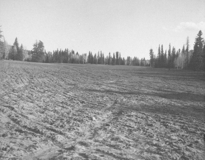
Tommy Creek
1958
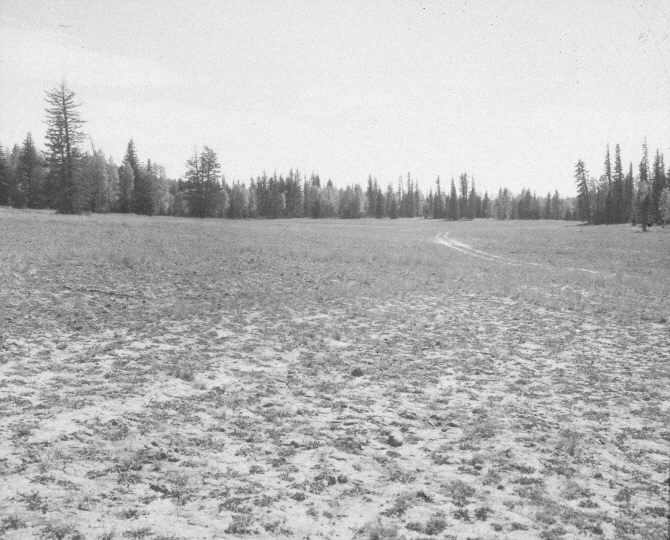
1959
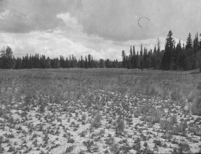
1961
Description:
Plate 1111X. Tommy Creek 1958 – 1959 – 1961 – 2005 Viewed southeast in upper Tommy Creek. The 1958 image was made immediately after the area had been root-plowed and reseeded by the Forest Service to improve range conditions, while the 1959 photo was taken after the first growing season and the 1961 image after three growing seasons. Today the seeded area is mostly smooth brome. The site was actively being grazed by cattle in 2005. In the distance, aspen has declined while spruce, white fir, and Douglas fir have increased. Plates 1110x and 1111x were taken from the same photopoint.
Photo Information:
U.S. Forest Service photographs (unnumbered) taken on October 7, 1958, in September 1959, and on July 7, 1961; retake by Charles E. Kay on September 2, 2005 - - Photo No. 5546-28A. Original photographs, negatives, and narrative reports held in the range files on the Cedar City Ranger District, Dixie National Forest, Cedar City, UT.
Vegetative Community:
Dry Meadow, Conifer, Aspen
Location:
South West: Section 14, Range 8 West, Township 37 South; UTM 349350 E, 4162000 N; elevation 8,920 ft.