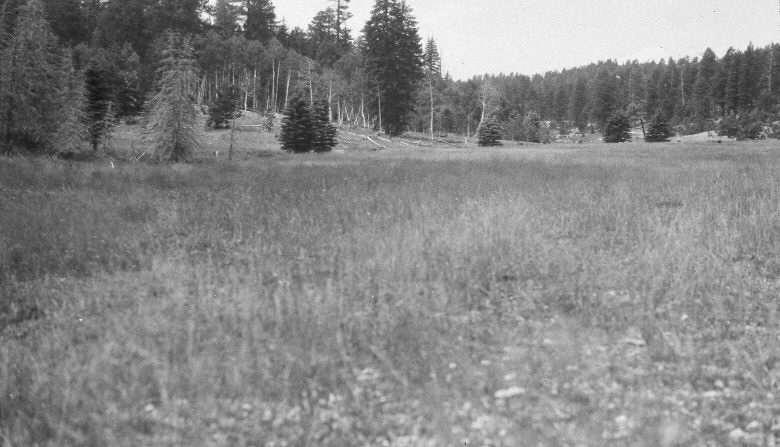
Swains Creek
1952
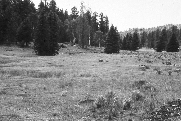
1986
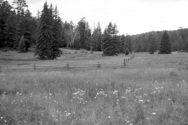
2005
Description:
Plate 957X. Swains Creek 1952 – 1986 – 2005 Viewed southwest up Swains Creek at the old beaver pond above Adair Hollow - - see Plate 559x. A riparian exclosure has been established around the former beaver pond but cattle had breached that fence in 2005. Nevertheless, the area was not as heavily grazed in 2005, as it was in 1986. Spruce, white fir and ponderosa pine have increased, while aspen has declined. The most common grasses are smooth brome, crested wheatgrass, and Kentucky bluegrass. Green rabbitbrush appears to have declined.
Photo Information:
U.S. Forest Service photographs (unnumbered) taken on August 20, 1952 and September 3, 1986; retake by Charles E. Kay on July 29, 2005 - - Photo No. 5488-23. Original photographs, negatives, and narrative reports held in the range files on the Cedar City Ranger District, Dixie National Forest, Cedar City, UT.
Vegetative Community:
Riparian, Conifer, Aspen, Dry Meadow
Location:
South West: Section 7, Range 7 West, Township 39 South; UTM 352125 E, 4143900 N; elevation 7,960 ft.