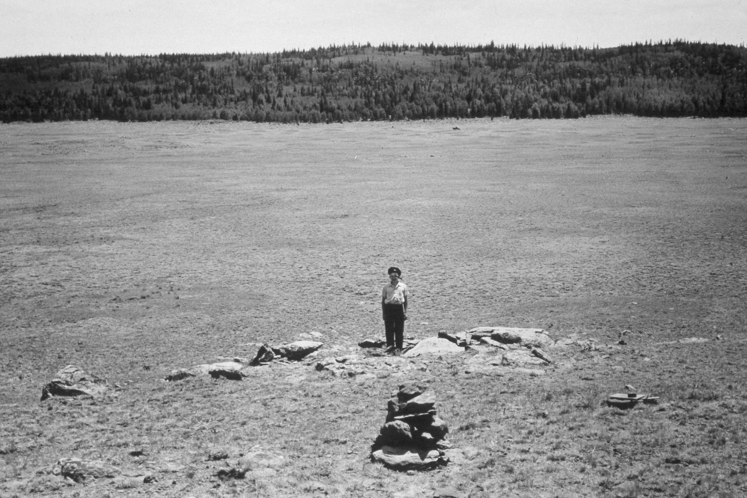
Rock Spring Draw
1943
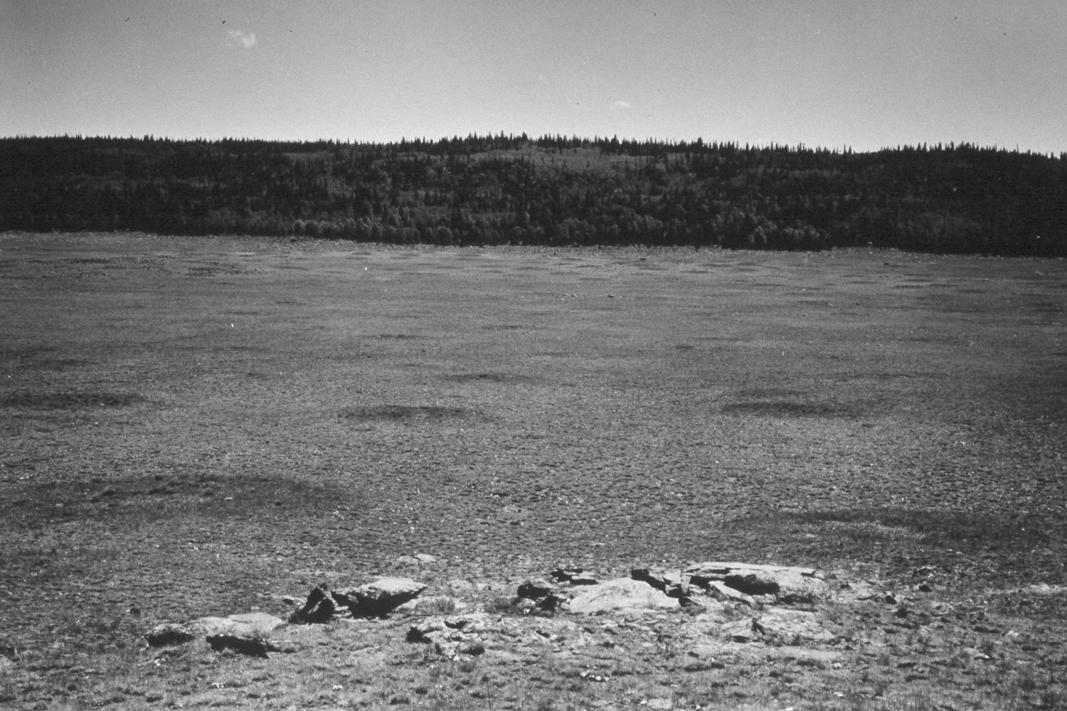
1948
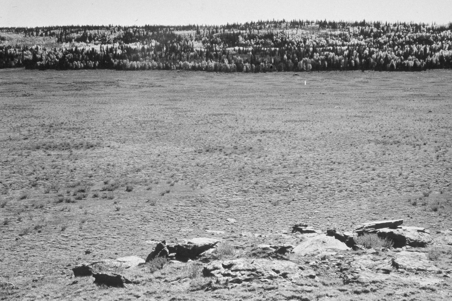
1953
Description:
Plate 327X. Rock Spring Draw 1943 - 1948 - 1953 - 1958 - 2003 The Rock Spring Draw Photo Plot Transect southeast of Big Lake on the Awapa Plateau was established in 1943 and reread in 1948, 1953, and 1959. In 1943, the range was described as being “in a serious state of forage depletion and erosion“ from use by cattle and domestic sheep. University of Utah plant ecologist Dr. Walter Cottam, who remeasured the transect in 1948, noted that “it appears that there has been little or no recovery…during the past five years and there are definite instances on these plots where the mounded, dying grass of five years ago have succumbed and the soil mound [eroded].” In 1953, it was reported that “both vegetation and soil trends were downward for the 1948 to 1953 period.” While in 1958, I.H. Johnson concluded that range conditions had not improved and that “soil losses must be greatly reduced” (unpublished reports in the range files on the Teasdale Ranger District, Dixie National Forest, Teasdale, UT). Plate 327x is viewed southeast back down the Photo Plot Transect to its starting point near the truck in the distance on the 1943 image. The person in the 1943 image is standing on the transect centerline. The entire area is dotted with mima mounds. Those circular features are especially visible in the 1948 and 2003 images. Mima mounds are slightly-elevated landforms created by pocket gophers over hundreds of thousands of years. Silver Sage has increased and is especially thick on the top of mima mounds where the soil is deeper. The entire area is very rocky with thin soils, except on the mima mounds. Despite the extended drought that has gripped southern Utah for several years, range conditions appear to have improved. The area was very heavily grazed by cattle in 2003, plus the area was also used by elk, deer, and antelope. In the distance, spruce has increased, while aspen has declined.
Photo Information:
U.S. Forest Service photographs (unnumbered) taken by Ray J. Davis on July 6, 1943; Walter P. Cottam on July 5, 1948; I.H. Johnson on September 24, 1953; and I.H. Johnson on August 5, 1958; retake by Charles E. Kay on August 24, 2003 - - Photo No. 5247-22. Original photographs, negatives, and narrative reports held in the range files on the Teasdale Ranger District, Dixie National Forest, Teasdale, UT.
Vegetative Community:
Sagebrush
Location:
South West: Section 33, Range 2 East, Township 31 South; UTM of transect starting point 440250 E, 4213600 N; elevation 9,810 ft.