Pot Holes Exclosures
1958
1995
2002
Description:
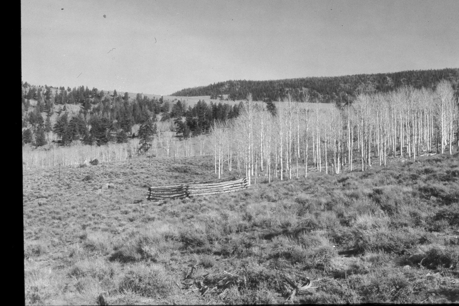
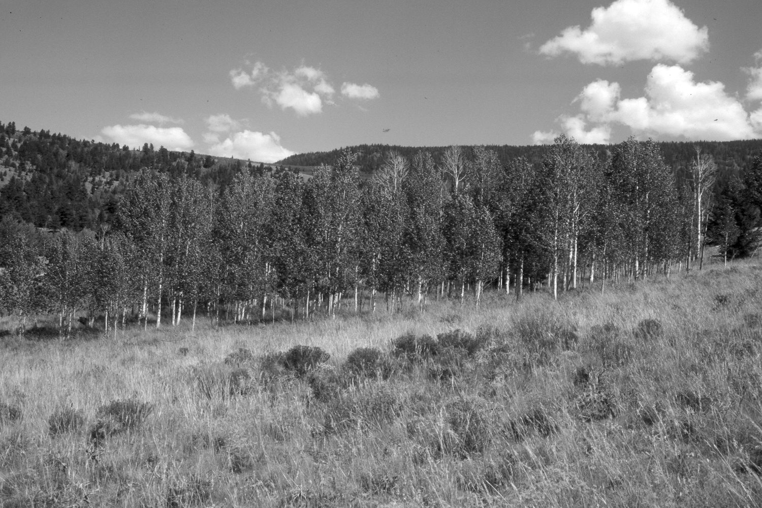
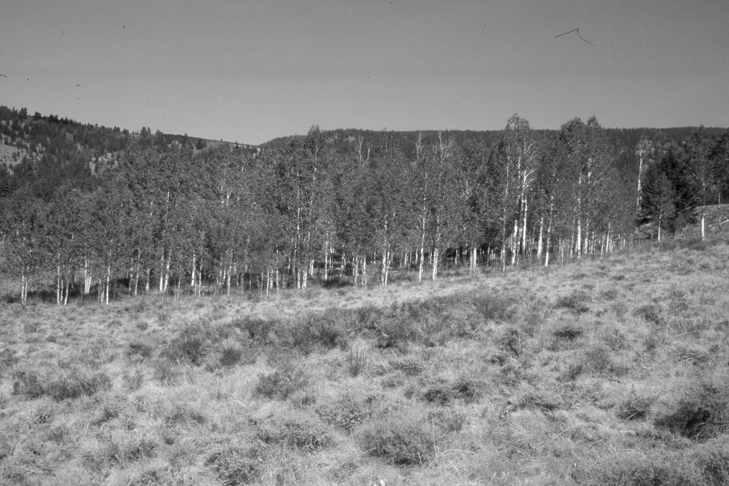
Plate 82X. Pot Holes Exclosure 1958-1995-2002 Viewed northeast to the Pot Holes aspen exclosure on the western flank of Boulder Mountain. The exclosure was constructed in 1958, and after cattle were excluded, aspen regenerated inside the fenced plot, but not in adjacent, unprotected stands (Kay and Bartos 2000) - - see Plate 81X. Since that time, mule deer have highlined all the aspen saplings inside the exclosure and prevented additional aspen regeneration (Kay and Bartos 2000). From 1958 to 1995, however, grass cover increased inside the exclosure where livestock were excluded. A decline in grass cover, though, had occurred by 2002 due to the extended drought that has gripped southern Utah for several years. Conifers have increased on the distant hillside.
Photo Information:
U.S. Forest Service photograph (unnumbered) taken in October 1958; retakes by Charles E. Kay on August 8, 1995 and July 13, 2002 - - Photo Nos. 3910-18 and 4985-32. Original photograph held by the Teasdale Range District, Dixie National Forest, Teasdale, UT.
Vegetative Community:
Aspen
Location:
South West: Section 27, Range 3 East, Township 30 South; UTM 449400E, 4225100N; elevation 9,040 ft.