Pelham Lake Ii
1948
1954
2003
Description:
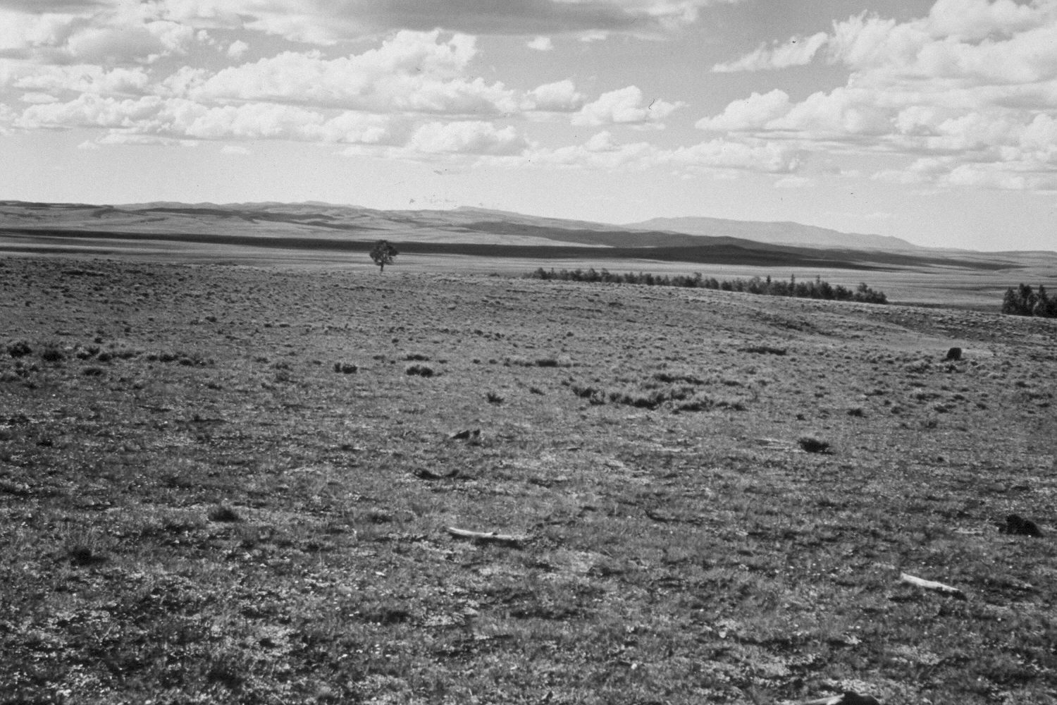
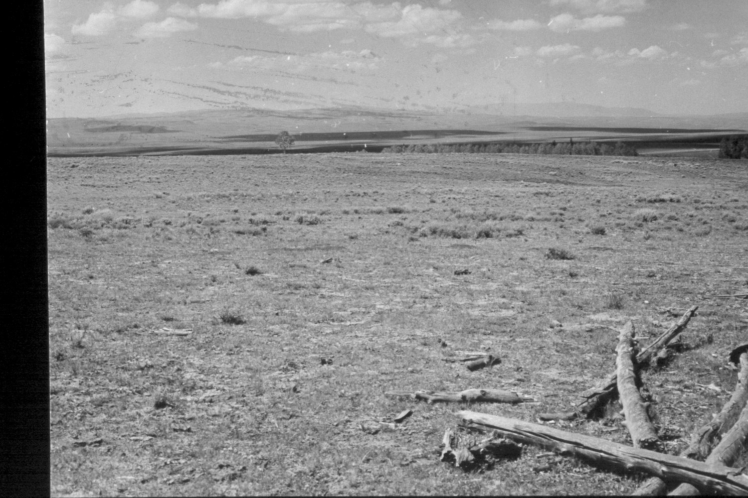
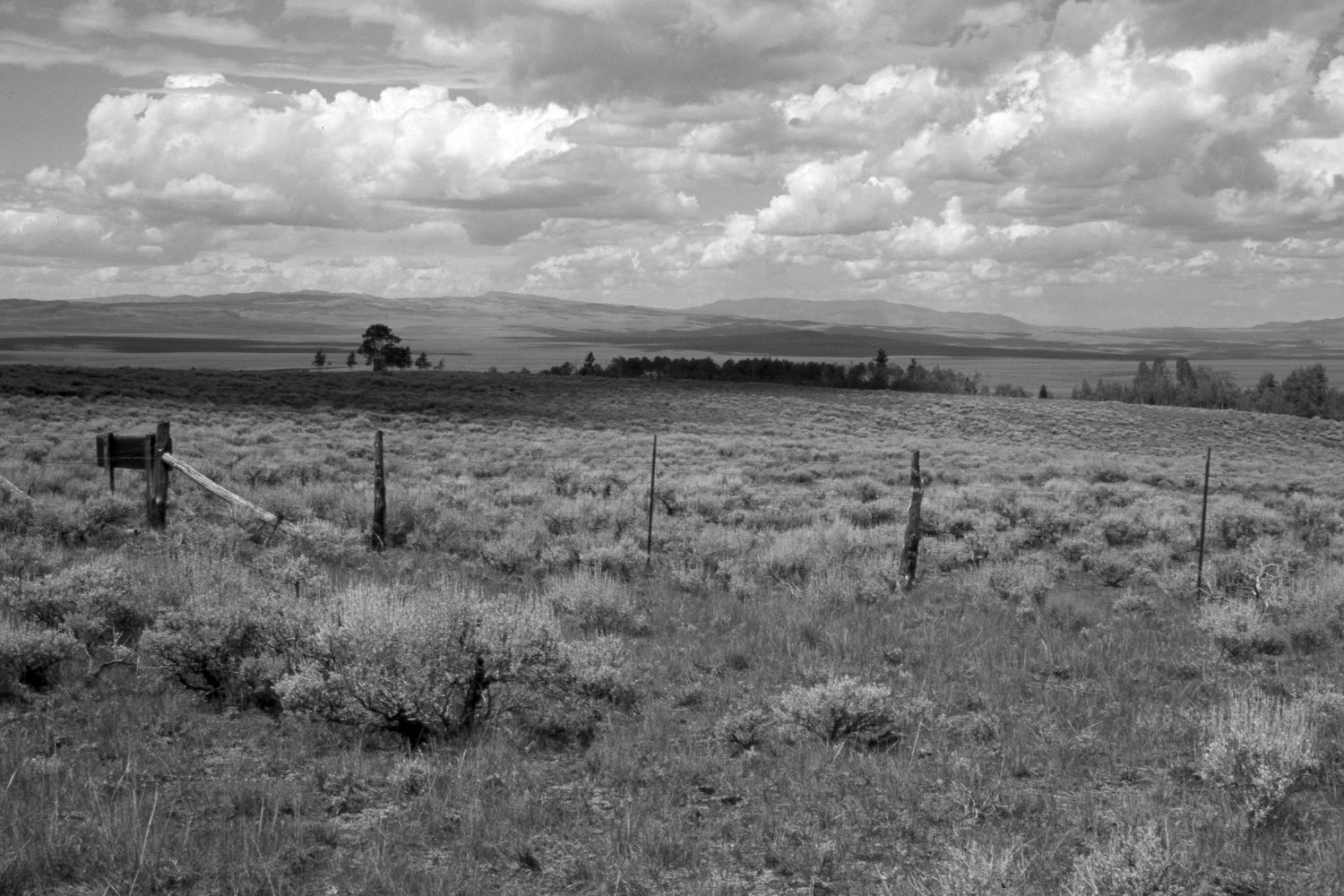
Plate 315X. Pelham Lake II 1948 - 1954 - 2003 The Pelham Lake Photo Plot Transect was established in 1943 and reread in 1948, 1954, 1958, and 1979. This Photo Plot Transect consists of two parts separated by about two miles on the Awapa Plateau. Pelham Lake I is located north of Pelham Lake and Pelham Knoll, while Pelham Lake II is located further east near Pelham Hollow. Both transects, though, sample similar range types and conditions. The Pelham Lake II Photo Plot Transect begins at the southwest corner of a pole exclosure built in 1928 and runs in a northwesterly direction. That small exclosure was removed in 1957 when a larger exclosure was constructed in its place. The original corners of the smaller exclosure, however, were marked with steel posts prior to its removal. The smaller exclosure area today is entirely aspen, while the larger exclosure contains aspen and sagebrush communities. Both exclosures excluded only livestock, not wildlife. Ray Davis, who measured Pelham Lake I and II in 1943, noted that “this [was] the poorest range [he had] seen this summer…the effects of overgrazing are very pronounced…aspen is the principle trees, and there is no reproduction…”. In 1948, University of Utah plant ecologist Dr. Walter Cottam remeasured the transects and noted that “better grazing practices over the past five years have doubtlessly improved the range but it is still in a sad state of depletion.” Dr. Cottam commented that aspen had not successfully regenerated in many years due to repeated browsing by cattle and domestic sheep. As relates to Pelham Lake II, Dr. Cottam reported that “the transect, located as it is where direct comparison may be made [to] a small enclosure of long standing, is extremely revealing.” Canopy cover of highly-palatable native grasses was almost 100% inside the exclosure, while it was nearly nil outside. Dr. Cottam noted that the area inside the exclosure “is the only area yet observed where there is a semblance of pristine condition [and]…it would be nothing short of a crime to permit the exclosure to be destroyed.” In 1958, range conditions on both transects were described as “poor to very poor,” with a downward trend. By 1979, range condition had improved, but only to a limited degree. According to Dr. Jim Bowns, “the present condition is only fair, but the trend has definitely been up in recent years” (unpublished reports in the range files on the Teasdale Ranger District, Dixie National Forest, Teasdale, UT). Plate 315x is viewed north-northwest from the transect starting point. Parker Mountain and Fishlake Hightop are on the distant skylines. Aspen now blocks the original view, so the 2003 retake was made from the outside edge of the aspen stand. The fence in the 2003 retake is the 1957 exclosure fence - - the area between the camera and the fence has not been grazed by livestock for 46 years, while the area beyond the fence is grazed yearly. Sagebrush has increased dramatically since 1943, but is not as abundant inside the fenced area, as it is outside. Grass cover is nearly 100% inside the exclosure, but has also increased on the open range. The outside area was heavily grazed by cattle in 2003. Aspen successfully regenerated inside both the 1928 and 1957 exclosures and the clone expanded in size replacing the sagebrush community - - see Plate 316x. Adjacent, but unprotected, aspen stands have not regenerated in nearly 100 years, except for a few clones that produced new stems greater than 6 feet tall during the 1970s when mule deer numbers were low. This is similar to what has been reported at other aspen exclosures in southern Utah (Kay and Bartos 2000). Elk, a species absent in 1943, and deer now use the area inside the exclosure to such an extent that those animals have highlined all the aspen saplings and repeatedly browsed all the aspen suckers preventing further stand regeneration. Elk are also starting to eat the bark from aspen trees outside.
Vegetative Community:
Aspen, Sagebrush
Location:
South West