Pelham Lake I
1943
1948
1954
Description:
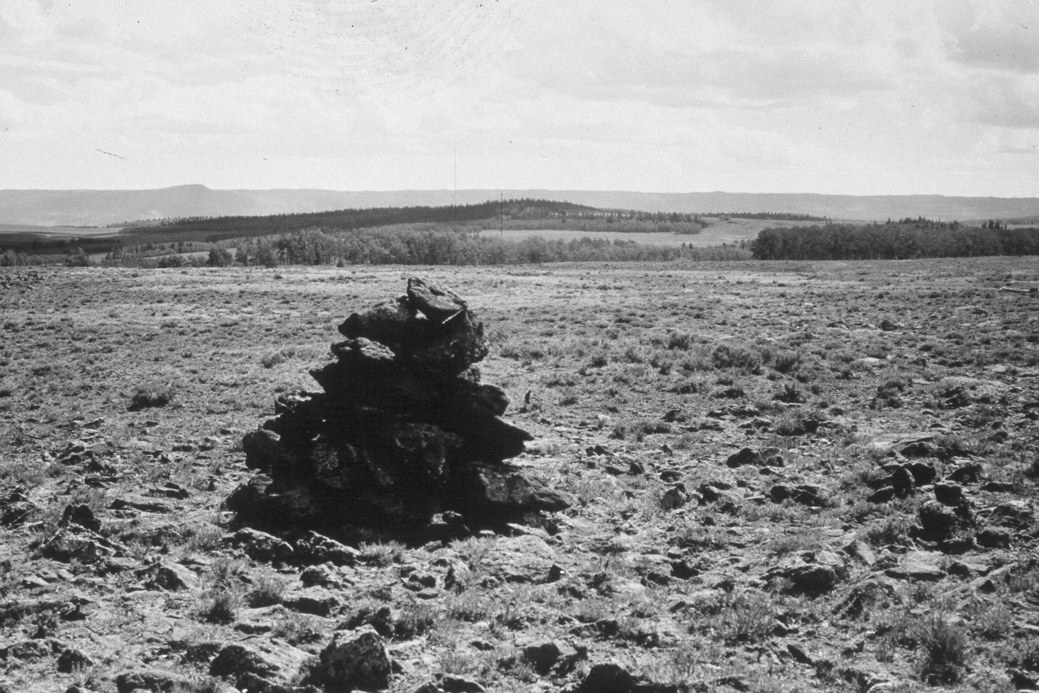
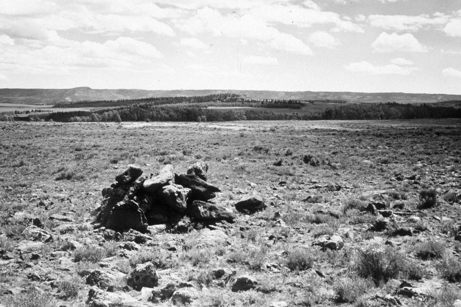
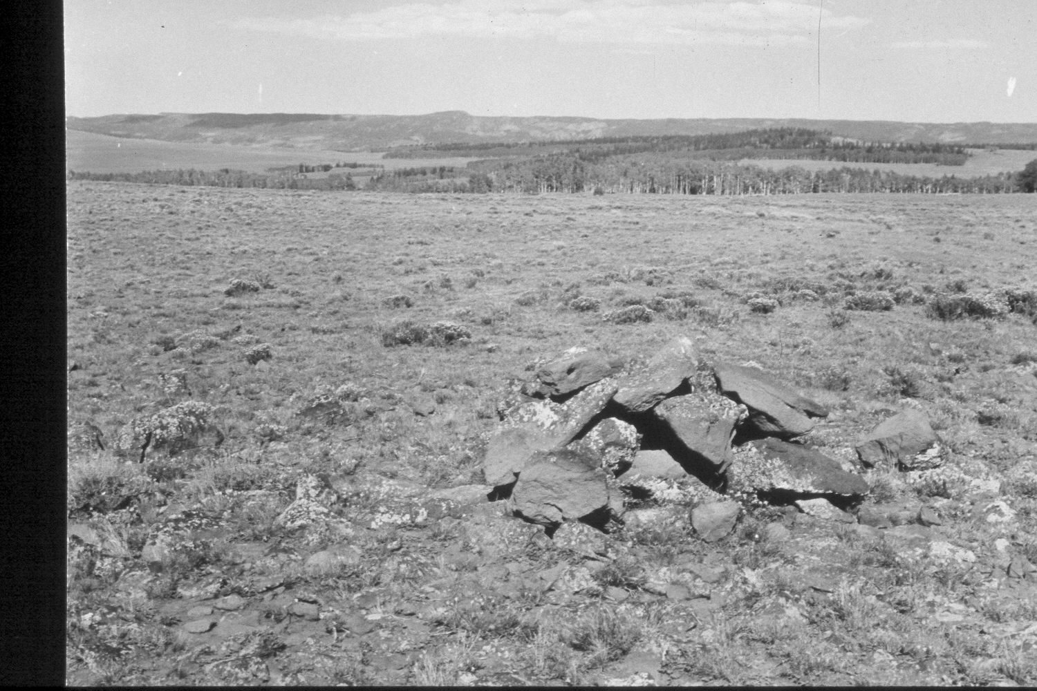
Plate 319X. Pelham Lake I 1943 -1948 - 1954 - 2003 The Pelham Lake Photo Plot Transect was established in 1943 and reread in 1948, 1954, 1958, and 1979. This Photo Plot Transect consists of two parts separated by about two miles on the Awapa Plateau. Pelham Lake I is located north of Pelham Lake and Pelham Knoll while Pelham Lake II is located further east near Pelham Hollow. Both transects, though, sample similar range types and conditions. The Pelham Lake I Photo Plot Transect begins at a rock carin approximately one-half mile north of Pelham Knoll and runs in an easterly direction. Ray Davis, who measured Pelham Lake I in 1943, noted that “between the sheep and cattle, they have eaten nearly all palatable material…[sheep] have eaten all the aspen leaves they can reach and there is no reproduction of aspen.” In 1948, University of Utah plant ecologist Dr. Walter Cottam remeasured the transects and reported that “better grazing practices over the past five years have doubtlessly improved the range but it is still in a sad state of depletion.” I.H. Johnson, who measured the transect in 1954 noted that “the range is in poor condition at best…and unless there is a marked change in use it receives…worthless species will dominate before very long.” Johnson reported that the trend was still downward in 1958. In 1979, Dr. Jim Bowns noted that Pelham Lake I and II were “a poor choice of transects because one…apparently crosses a sheep bedground and the other a stock driveway.” Dr. Bowns concluded that present range conditions were only “fair, but the trend has definitely been up in recent years” (unpublished reports in the range files on the Teasdale Ranger District, Dixie National Forest, Teasdale, UT). Plate 319x is viewed east down the transect centerline with Boulder Top on the distant skyline. The area is very rocky and is covered with mima mounds - - slightly-elevated circular structures created by pocket gophers over hundreds or thousands of years. Silver sage and threetip sage (Artemisia tripartita) are most abundant on top of the mima mounds where the soil is deepest. Green rabbitbrush is also present, but was defoliated by grasshoppers in 2003. The area was heavily grazed by cattle in 2003 and also used by elk, mule deer, and pronghorn antelope. A few aspen stands successfully regenerated during the early 1970s when mule deer numbers were low (Kay and Bartos 2000), but today those saplings have been highlined and all aspen suckers repeatedly browsed.
Photo Information
U.S. Forest Service photographs (unnumbered) taken by Ray J. Davis on July 7, 1943; Walter P. Cottam on July 6, 1948; I.H. Johnson on August 18, 1954; retake by Charles E. Kay on August 24, 2003 - - Photo No. 5240-33. Original photographs, negatives, and narrative reports held in the range files on the Teasdale Ranger District, Dixie National Forest, Teasdale, UT.
Vegetative Community:
Sagebrush, Aspen
Location:
South West: Section 13, Range 1 East, Township 31 South; UTM of transect starting point 435600 E, 4217700 N; elevation 9,690 ft.