Pacer Lake
1943
1948
1953
Description:
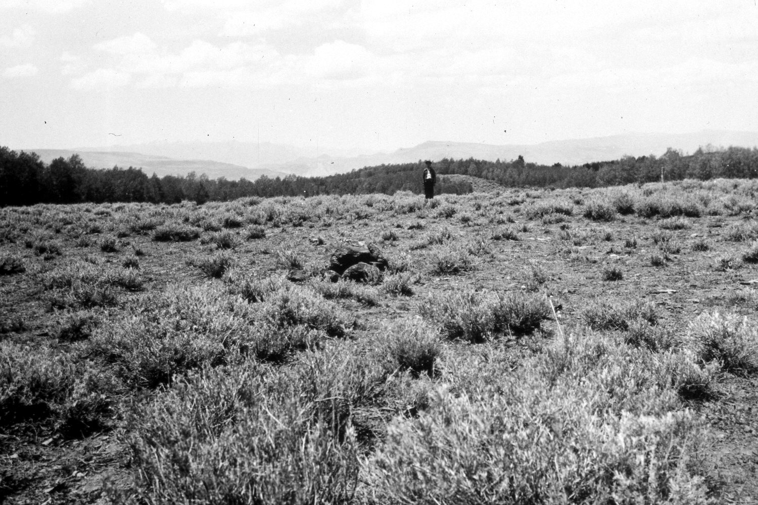
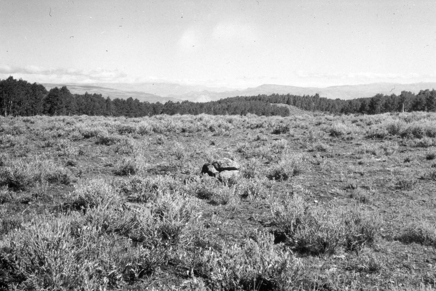
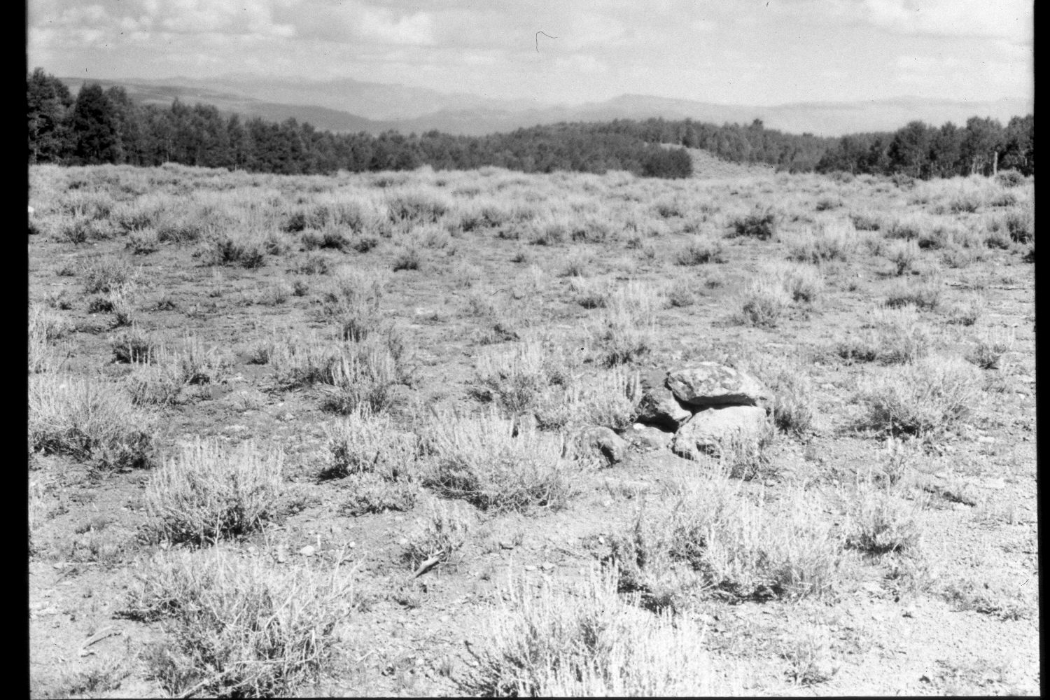
Plate 391X. Pacer Lake 1943 - 1948 - 1953 - 2003 The Pacer Lake Photo Plot Transect (a.k.a. Coyote Zone II) on the westside of Escalante Mountain was established in 1943 and reread in 1948, 1953, and 1979. The transect is situated on a low pass approximately 400 yards south of Pacer Lake. The transect consists of two segments. The first leg is 1000 feet in length and runs in a northwesterly direction from a common starting point, while the second leg is 1500 feet in length and runs in an easterly direction. The first leg samples a silver sage meadow, while the second leg samples silver sage and aspen communities. When the transect was established, the area was very heavily grazed by cattle. “All the aspen have been hedged as high as the animals can reach, and many trees have died…There is very little reproduction of aspen here, but 2-3 miles south where livestock have been fenced out,…aspen is reproducing in fine shape.” Conditions had improved by 1948, however, and there was “a great display of aspen regeneration…two to three years old.” Sheet erosion, though, was common in the sage meadow. In 1953, Range Conservationist I.H. Johnson found that there was no noticeable improvement in the vegetation trend but that the soil trend was still down. “Range condition is very poor to poor.” After remeasuring the transect in 1979, Dr. Jim Bowns, range ecologist at Southern Utah University, observed that “It is apparent now that this area has improved [since 1943]…this is most noticeable in the increase of herbaceous species and the abundance of aspen shoots. This range is probably no better than a high fair condition…,but the trend is up” (unpublished reports in the range files on the Escalante Ranger District, Dixie National Forest, Escalante, UT). Plate 391x is viewed north-northwest down the first leg of the Photo Plot Transect at its starting point near the rock carin in the foreground. The person in the 1943 image is standing on the transect centerline. The white flagging in the 2003 retake marks the rock carin, which has succumbed to the elements. Silver sage has increased. Most aspen stands in the immediate area have not successfully regenerated in many years due to repeated browsing of aspen suckers by livestock, elk, and mule deer. The transect was heavily grazed by cattle in 2003. The main grasses are needle and thread, squirreltail (Sitanion hystrix), and Stipa spp. In the distance, Forshea Mountain is above the transect centerline, while the Tusher Mountains are on the left skyline.
Photo Information:
U.S. Forest Service photographs (unnumbered) taken by Ray J. Davis on June 23, 1943; Walter P. Cottam on June 23, 1948; and I.H. Johnson on August 17, 1953; retake by Charles E. Kay on August 31, 2003 - - Photo No. 5277-30. Original photographs, negatives, and narrative reports held in the range files on the Escalante Ranger District, Dixie National Forest, Escalante, UT.
Vegetative Community:
Sagebrush, Aspen
Location:
South West: Section 34, Range 1 West, Township 32 South; UTM of transect starting point 421500 E, 4204000 N; elevation 9,400 ft.