Navajo Lake
1939
2004
2005

Description:
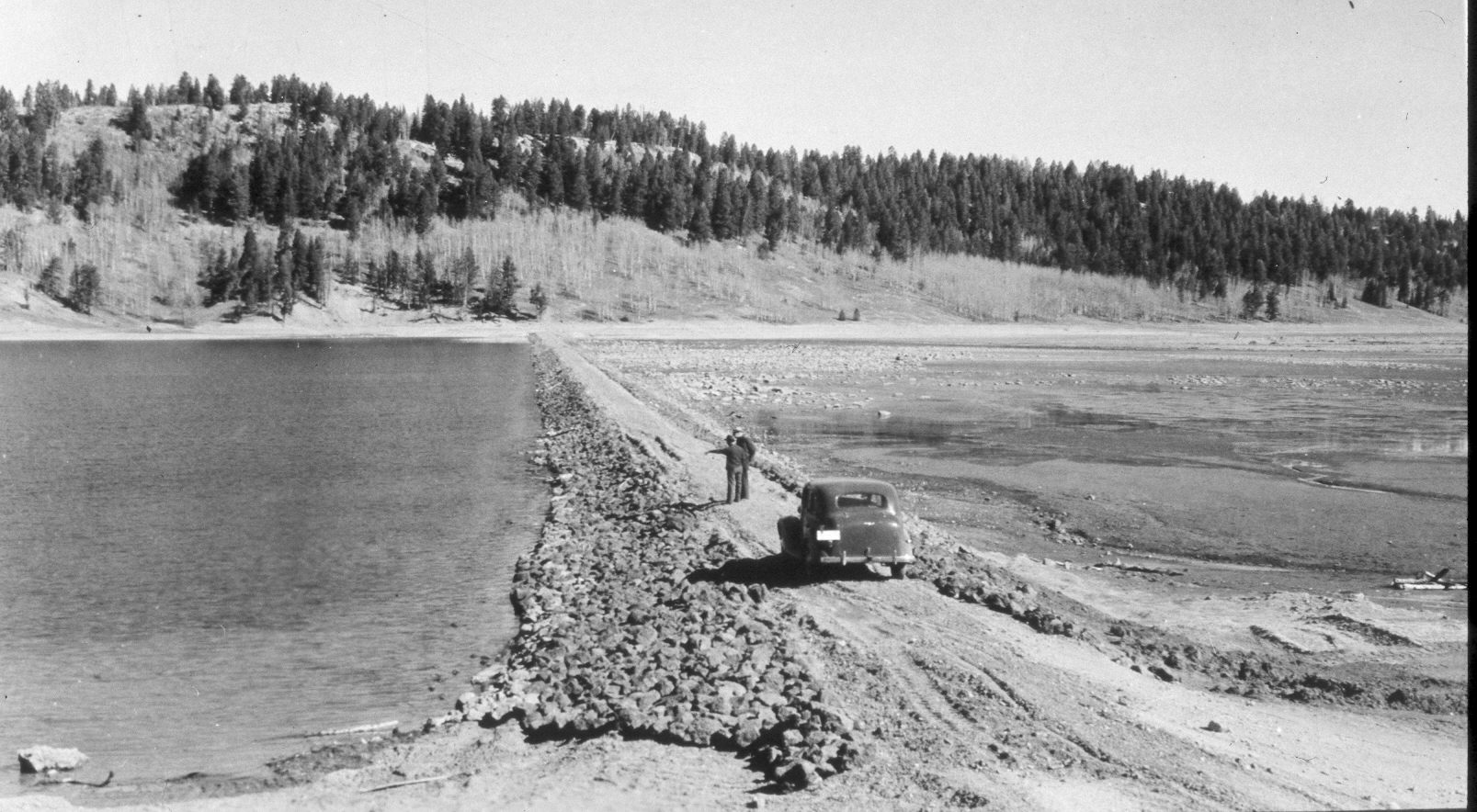
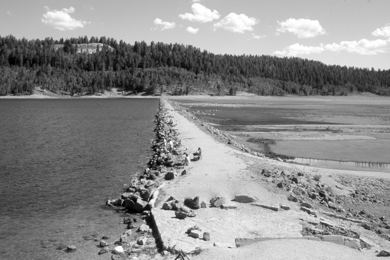
Plate 615X. Navajo Lake 1939 – 2004 - 2005 Viewed north along the dam on Navajo Lake. The original image was made shortly after the dam had been rebuilt following its failure earlier in the year - - see Plates 612x and 613x. In the distance, ponderosa pine and Douglas fir have increased, while aspen has declined. The rock cut on the left skyline is the overlook on Utah Highway 14 - - see Plates 605x and 606x. A new spillway has been added. The second retake was made a year later after the lake filled following an exceedingly wet winter and spring. The water was so deep in 2005 that the dam was entirely submerged.
Photo Information:
U.S. Forest Service photograph taken in May 1939; retakes by Charles E. Kay on August 10, 2004 - - Photo No. 5383-31A and July 29, 2005 - - Photo No. 5485-20A. Original photograph held by Southern Utah University Archives and Special Collections, Cedar City, UT.
Vegetative Community:
Riparian, Conifer, Aspen
Location:
South West: Section 8, Range 8 West, Township 38 South; UTM 344100 E, 4153650 N; elevation 9,030 ft.