Mule Flat
1943
1946
1953
Description:
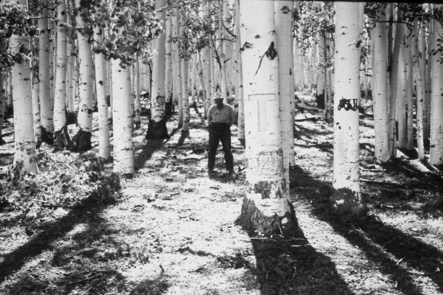
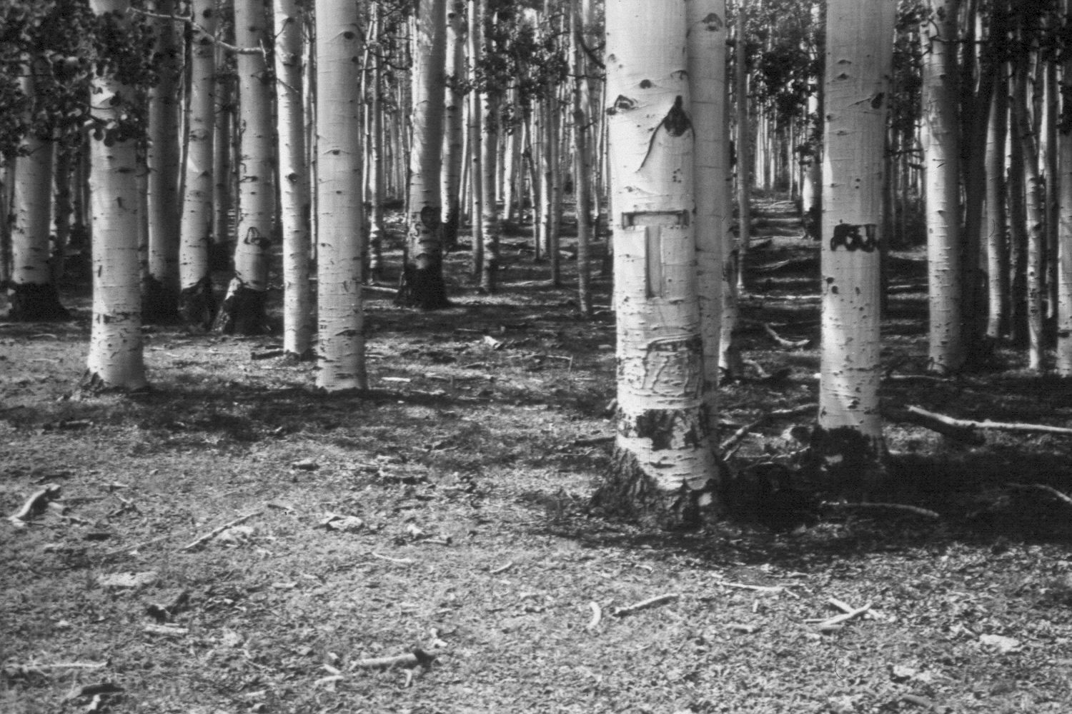
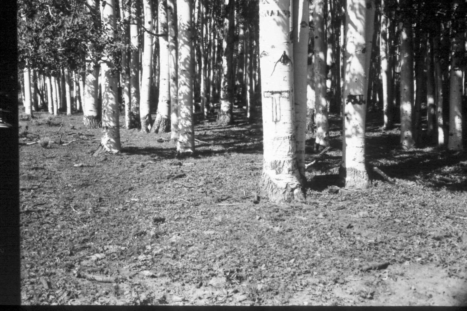
Plate 165X. Mule Flat 1943 - 1946 - 1953 - 1959 - 2003 The Mule Flat Photo Plot Transect was established in 1943 and reread in 1946, 1953, and 1959. Initial range conditions were described as poor and all plant communities were very heavily grazed. Sheet erosion in the meadow was common. All aspen suckers were repeatedly browsed by cattle and deer, as was snowberry. Range conditions had not improved by 1959 (unpublished reports in range files, Panguitch Ranger District, Panguitch, UT). Plate 165x is viewed west-southwest along the transect centerline from plot D-254. The site was clearcut sometime after 1959 to stimulate aspen regeneration but the new suckers were repeatedly browsed by wildlife and livestock until they were all killed. This part of the aspen stand is now dead or extinct, as no live suckers were observed in 2003. Grass cover, however, has increased dramatically despite the extended drought. The shrubs seen in the 2003 retake are snowberry. Most aspen stands in the immediate area have not successfully regenerated in many years due to repeated browsing (Kay and Bartos 2000). Within a half mile of this Photo Plot Transect, the U.S. Forest Service prescribe-burned an aspen stand and then built a four-part exclosure within the last 10 years to measuring grazing impacts. Aspen successfully regenerated only where wildlife, mostly elk and to a lesser extent deer, were excluded. By comparison, cattle had relatively little impact on aspen regeneration (personal observation and unpublished photos).
Photo Information:
U.S. Forest Service photographs (unnumbered) by Ray J. Davis on August 24, 1943; Walter Cottam on August 24, 1946; I.H. Johnson on August 7, 1953; and I.H. Johnson on September 16, 1959; retake by Charles E. Kay on July 11, 2003 - - Photo No. 5178-25. Original photographs, negatives, and narrative reports held in the range files on the Panguitch Ranger District, Dixie National Forest, Panguitch, UT.
Vegetative Community:
Aspen
Location:
South West: Section 24, Range 3 West, Township 31 South; UTM of transect starting point 399050E, 4217000N; elevation 9,620 ft.