Mcgrath Lake
1872
2002
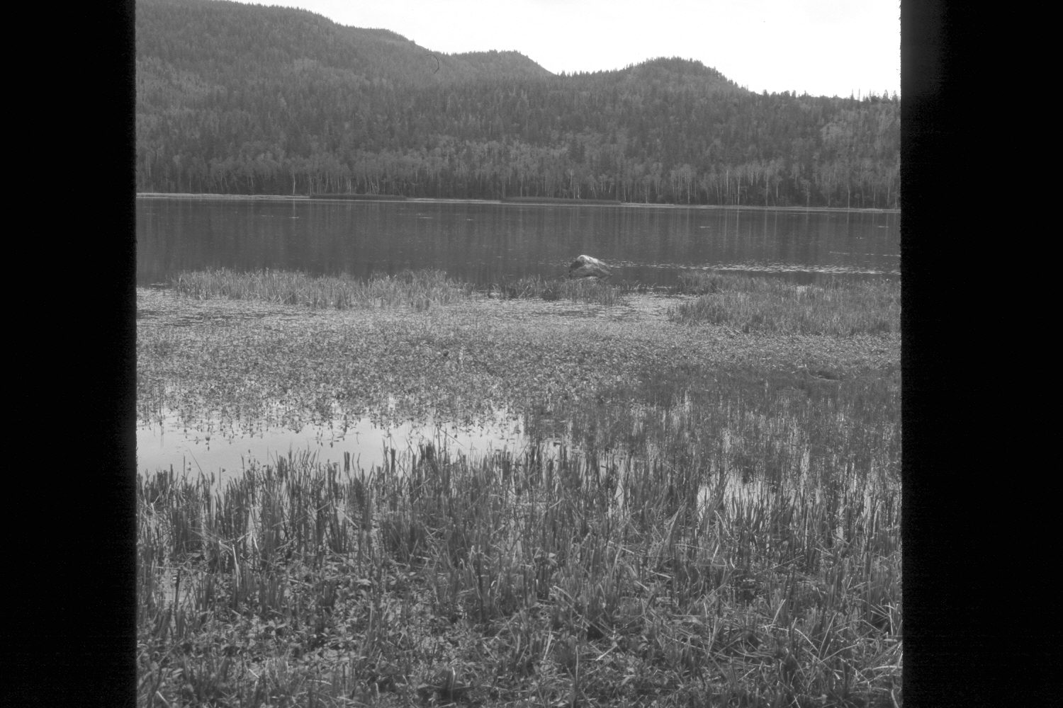
Plate 90X
Description:
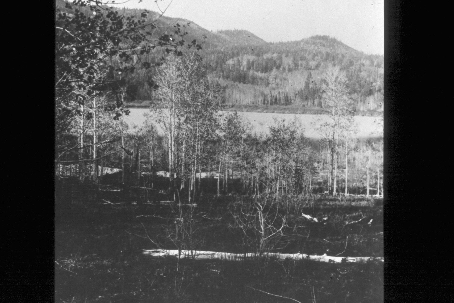
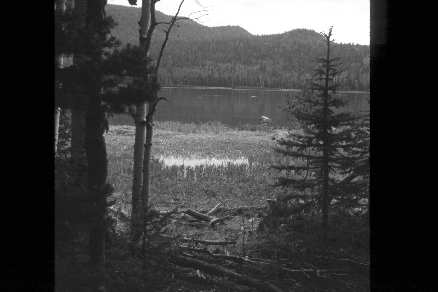
Plate 90X. McGath Lake 1872-2002 The 1872 photo shows a multi-aged, regenerating aspen community between the camera and McGrath Lake on the southside of Boulder Mountain. The vegetation in the original had never been grazed by livestock, as this area was not settled until after the photograph was taken. The original aspen also showed no sign of browsing by either deer or elk, unlike today, and suggest that present wildlife numbers are not reflective of historical conditions. The original photopoint could not be precisely relocated because, in the absence of the frequent, low-intensity fires that once swept this area, a dense forest has now become established. Aspen trees have matured only to be invaded by conifers, primarily spruce and supalpine fir. The retakes, which were made at 100 feet, 50 feet, 25 feet and zero feet from the lake shore, illustrate how the forest has grown-up. Across the lake, conifers in the original were primarily Douglas fir and spruce that apparently survived repeated non-crown fires, as judged by the interspersed regenerating aspen. Many of those trees, though, grew on rocky outcrops, or other fire refugia, where the sparse ground cover limited the spread of fire. Today, however, those hillsides are covered with dense growths of regenerating conifers, primarily spruce and subalpine fir, and would now support high-intensity, stand-replacing, crown fires, something that never happened in the past. In addition, an irrigation dam has been built on the outlet raising the lake’s level, and flooding-out the original riparian vegetation, especially the willow communities present on the far shore in 1872 viewed northwest.
Photo Information:
John Hillers photo 526 taken on June 9, 1872 (Fowler 1972: 118); retakes by Charles E. Kay on August 1, 2002 - - Photo Nos. 4996-26, 4996-29, 4996-30, and 4996-35. Original photo (RG-057-PS) held by the National Archive.
Vegetative Community:
Aspen, Conifer
Location:
South West: Section 28, Range 3 East, Township 32 South, UTM 449850 E, 4205700 N; elevation 9,380 ft.