Long Valley
1954
1959
2005
Description:
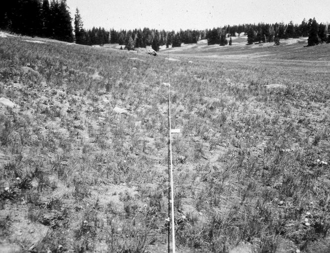
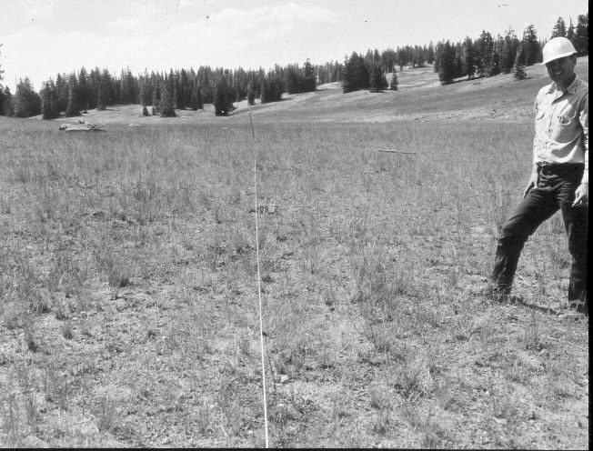
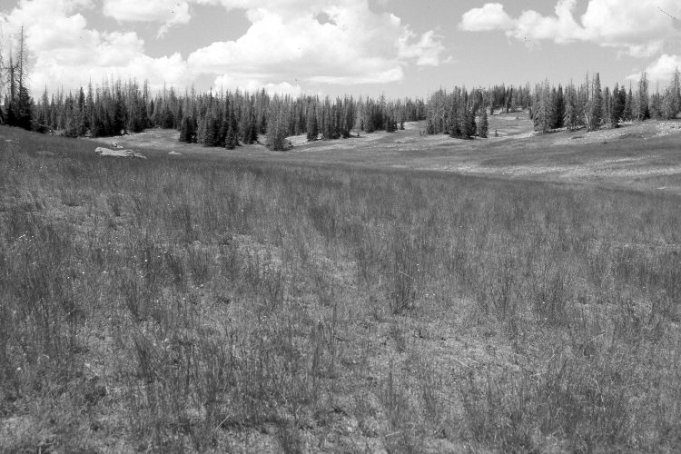
Plate 1107X. Long Valley 1954 – 1959 – 2005 Viewed west-northwest along line two of the Parker Three-Step Transect in Long Valley. The area was heavily used by domestic sheep in 2005, as it was between a bed ground - - up the hill on the left - - and a watering area - - off the photo to the right. Nonetheless, ground cover appears to have increased, while bare soil has declined. The area is a Stipa spp. grassland with a scattering of forbs. Spruce has increased over the years but many of the older trees were recently killed by insects and disease. The fence in the distance (photo upper-right) is Cedar Breaks National Monument’s boundary.
Photo Information:
U.S. Forest Service photographs (unnumbered) taken on June 29, 1954 and August 12, 1959; retake by Charles E. Kay on September 1, 2005 - - Photo No. 5544-29. Original photographs, negatives, and narrative reports held in the range files on the Cedar City Ranger District, Dixie National Forest, Cedar City, UT.
Vegetative Community:
Dry Meadow, Conifer
Location:
South West: Section 12, Range 9 West, Township 37 South; UTM 338350 E, 4163100 N; elevation 10,180 ft.