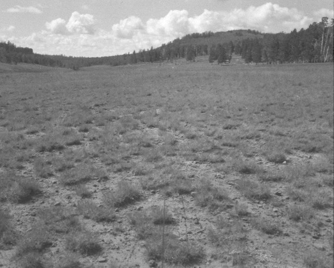
Left Fork Of Haycock Creek
1957
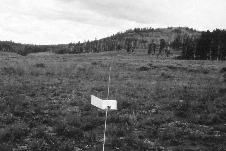
1983
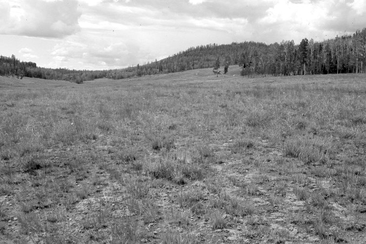
2005
Description:
Plate 1047X. Left Fork of Haycock Creek 1957 – 1983 – 2005 Viewed south-southwest along line two of the start of the Parker Three-Step Transect on the left fork of Haycock Creek north of Panguitch Lake. The area is dotted with mima mounds, which because of their deeper soils, support denser growths of silver sage. The meadow has not been treated and is mostly Stipa spp., needle and thread, squirreltail, Poa spp., and Festuca spp. Silver sage is the most common shrub. Conifers have increased, though, many of the older spruce have recently been killed by insects and disease. Aspen has declined but some stands did regenerate 30 years ago when mule deer population were low, but not before or since due to repeated ungulate herbivory (Kay and Bartos 2000). Today, those aspen saplings have all been highlined by elk and deer. The area is grazed by cattle. USFS road 082 is on the right.
Photo Information:
U.S. Forest Service photographs (unnumbered) taken on August 23, 1957 and August 3, 1983; retake by Charles E. Kay on August 6, 2005 - - Photo No. 5521-35A. Original photographs, negatives, and narrative reports held in the range files on the Cedar City Ranger District, Dixie National Forest, Cedar City, UT.
Vegetative Community:
Dry Meadow, Sagebrush, Conifer, Aspen
Location:
South West: Section 8, Range 7 West, Township 35 South; UTM 353800 E, 4183400 N; elevation 9,230 ft.