Lake Hollow
1943
1948
1953
Description:
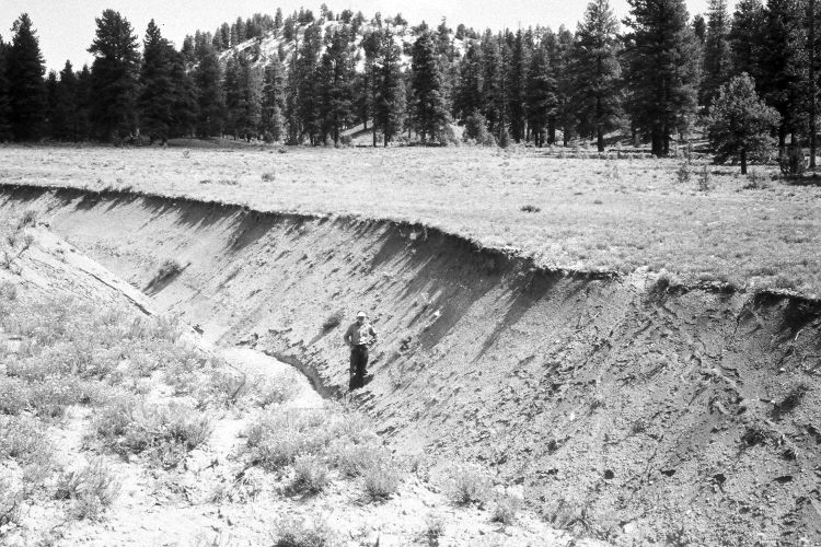
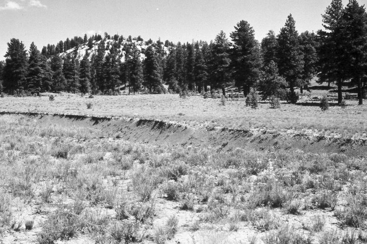
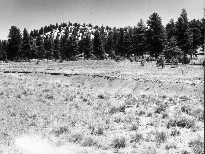
Plate 1031X. Lake Hollow 1943 – 1948 – 1953 – 2005 This Photo Plot Transect was established by the Forest Service in 1943 to monitor range conditions at Lake Hollow south of Panguitch Lake. According to early narrative reports, the area was very heavily grazed by livestock and soil erosion was common when monitoring began. “This valley, like most, is gutted by an ugly wash, 10 feet deep extending throughout its length…soil is in a serious state of depletion. Besides the large wash, shoestring gullies are numerous along the gentle slopes and clay is deposited in the valley bottoms. Erosion pavement if found everywhere on…slopes exceeding 5%. It is probable that lambing in this area [by domestic sheep] is extremely detrimental to this range because of too early use.” “Much of the area of the Mammoth Creek drainage from Panguitch Lake road south to the [Lake Hollow] transect shows great grazing abuse. Washes 12 to 15 feet deep are common and still active. Hardly a drainage, however small, is free from there gully systems. Bottoms that formerly were doubtlessly grassy have thus been drained and in many areas grasses have been replaced by worthless Gutierrezia [snakeweed] or Actinea [Hymenotys sp.]. From the Panguitch Lake road to this transect requires 15 miles of travel through one of the most disgracefully abused areas seen anywhere in Utah.” When the Transect was remeasured in 1978, Dr. Jim Bowns reported that, “condition seems to vary in this area but overall the present condition appears to be fair and the trend stable. Erosion is still apparent in the main drainages and will continue for some time…undesirable shrubs are abundant.” Dr. Bowns also noted that the area had “been logged since the transect was established….” Plate 1031x is viewed northeast from near subplot C-244 along the transect to its end point. The area is apparently no longer a sheep allotment, but instead was heavily grazed by cattle in 2005. Despite being one of the wettest years on record, there was very little grass and what there was, was mostly western wheatgrass. Unpalatable woody shrubs, including mountain big sage, three-tipped sage, snakeweed, green rabbitbrush, rubber rabbitbrush, and horsebrush, have increased. Fringed sage, rose, and currants, were also present. Despite selective logging, ponderosa pine and juniper have increased. The gullies have not healed and are still actively eroding.
Photo Information:
U.S. Forest Service photographs (unnumbered) taken by W.P. Cottam on August 12, 1943 and August 13, 1948, and by I.H. Johnson on June 10, 1953; retake by Charles E. Kay on August 4, 2005 - - Photo No. 5514-27. Original photographs, negatives, and narrative reports held in the range files on the Cedar City Ranger District, Dixie National Forest, Cedar City, UT.
Vegetative Community:
Dry Meadow, Sagebrush, Conifer, Juniper
Location:
South West: Section 25, Range 7 West, Township 36 South; UTM of the Transect mid-point 359600 E, 4168000 N; elevation 7,760 ft.